Water...Water...Water
August 2023 - Scenic Hwy 47 Mesa Falls Scenic Byway, #58-2023
DISCOVERIESNATURE
AL
8/28/2023
It has been a rough few days here personally, but we are working through it, so my apologies for not posting regularly. Here is one of our adventures.
On the same day that we ventured out to see Big Springs, we spent the rest of the day delighting in the sights along and near Idaho Highway 47, also known as the Mesa Falls Scenic Byway. In all, Tom found 4 waterfalls and an old abandoned railroad tunnel for us to explore. We started out on the north end of the highway in the sagebrush and grasses of the prairie. But the road soon turned more wooded, with the pine and spruce trees on the forested slopes near the creeks and rivers that flow over the now rocky terrain.
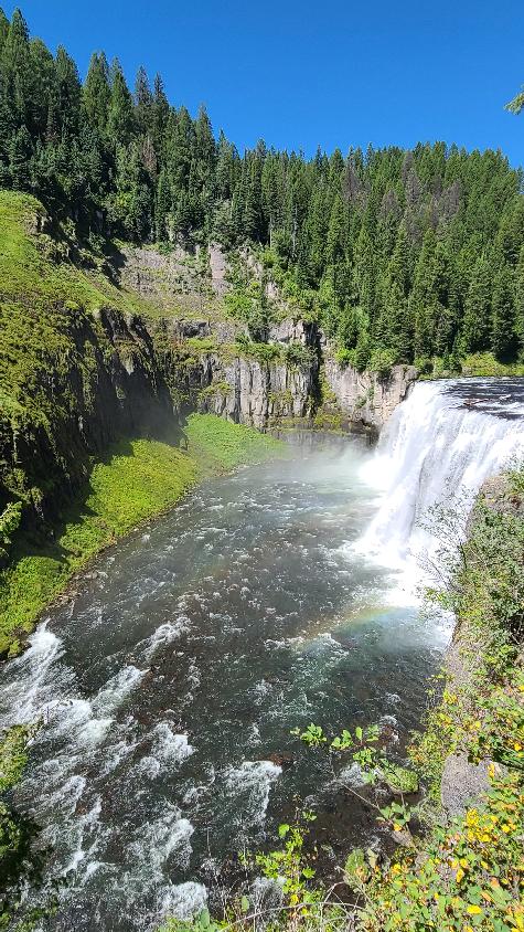
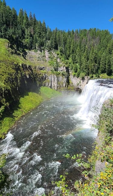
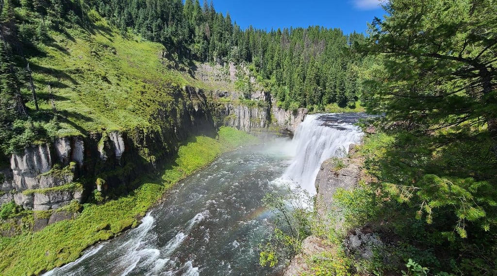
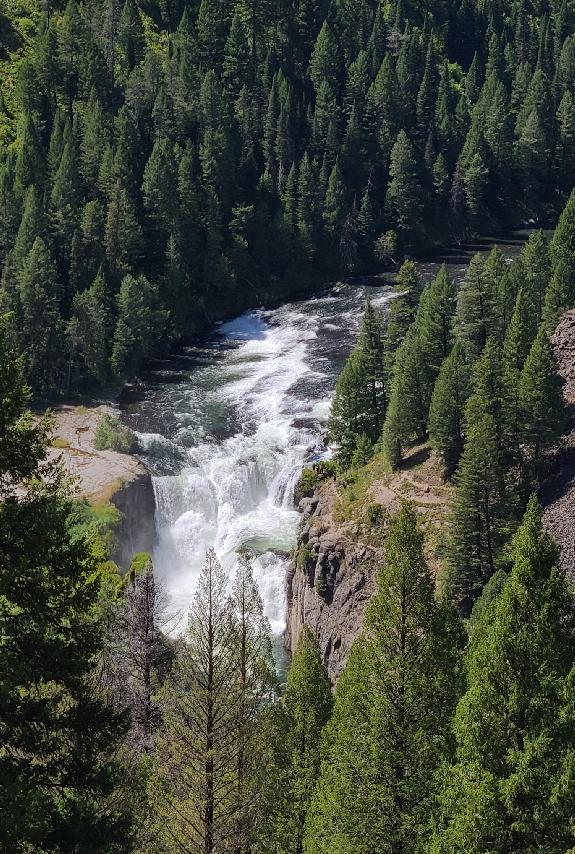
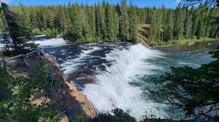
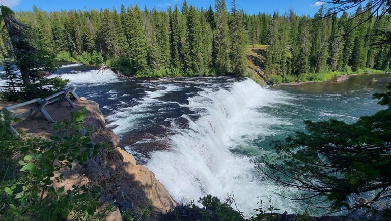
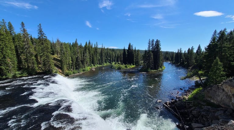
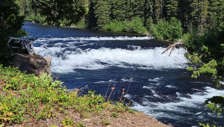
Upper Mesa Falls , which is located in a state park, was our first waterfall of the day. After loading Cassie in her backpack and Suki on her leash we headed from the parking area along the pathways and down the stair steps to the viewing area for the falls. The thundering waters of Henrys Fork could be heard before we seen the falls itself. This is the same river that we had seen begin at Big Springs, and it obviously increased in size and volume. The falls are 114 feet tall and over 200 feet wide where it cascades over the ledge that has been created over the centuries. We even caught a rainbow reflected in the spray from the falls. Above the falls on the hillside sits the Visitor Center. It is located in a large log structure (of which I forgot to take a photo) constructed in 1912 as the Big Falls Inn, and it was a popular place for gatherings and events up until the 1950’s. It then sat vacant until the 1980’s, when it was acquired by the Forest Service, and eventually restored to be used as the Visitor Center. There are many displays and much information inside.
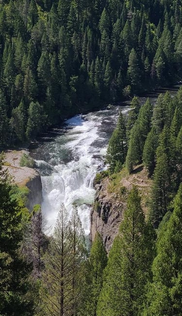
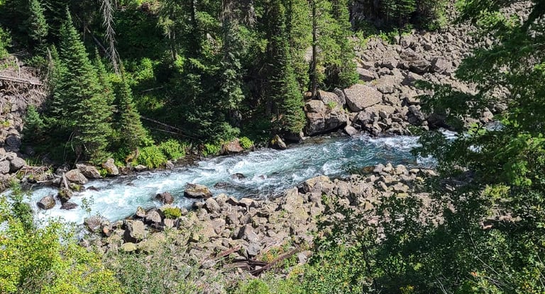
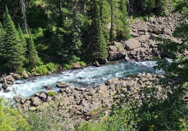
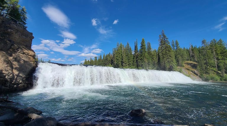
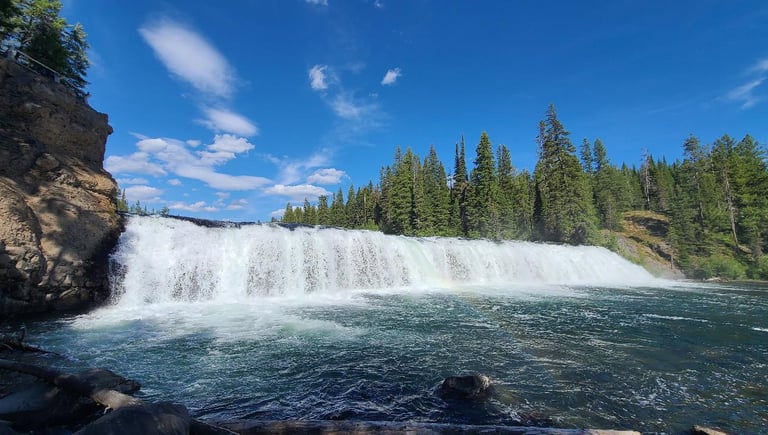
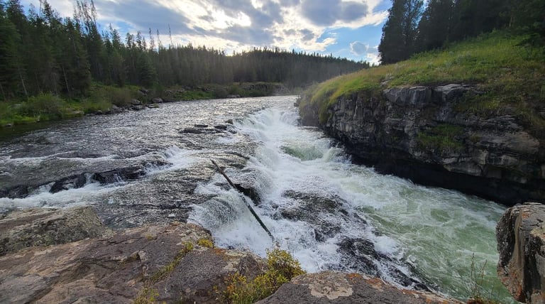
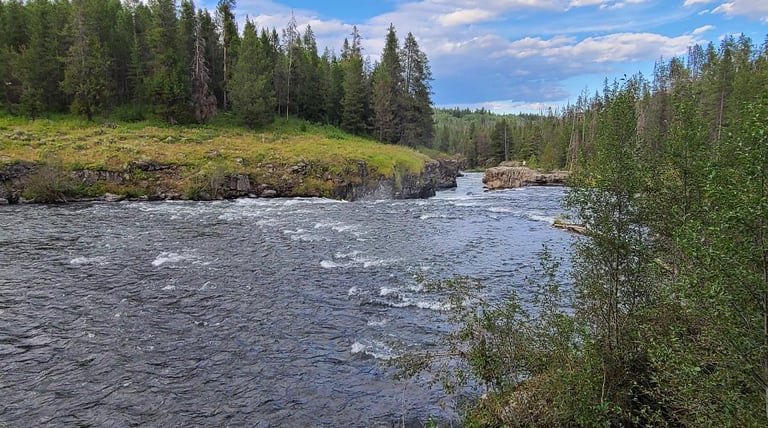
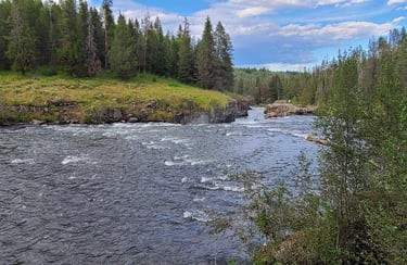
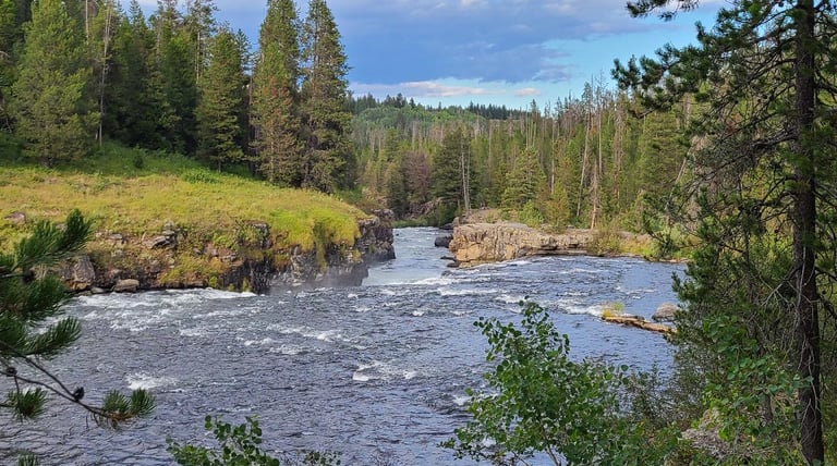
Just a short distance down the road we encountered the overlook for Lower Mesa Falls. It is not quite as tall or wide as the upper falls, but the water roars as just as strong as it flows over the edge, crashing to the canyon floor below. We could see how the harder rock is slowly loosing the fight against the strength of the rushing waters, while standing at the stone overlook that was built by the CCC in the 1930’s. The falls along Henrys Fork are the last ones on the Snake River system to resist human control.

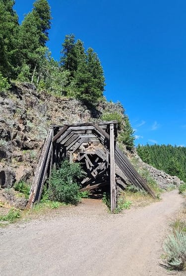
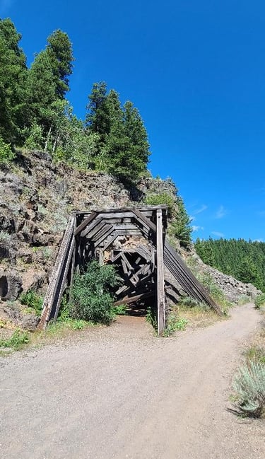
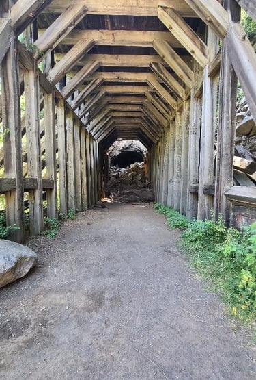
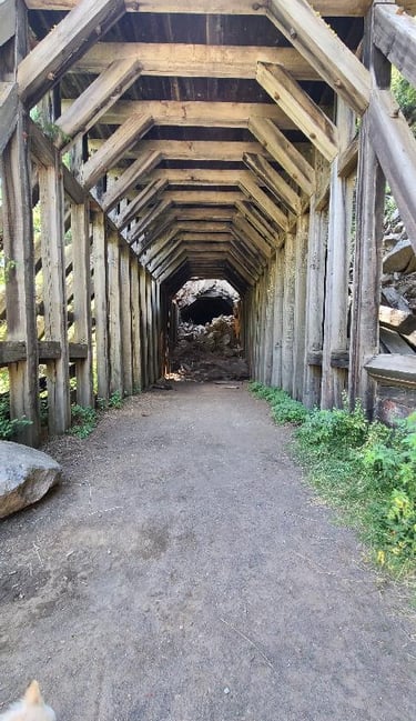
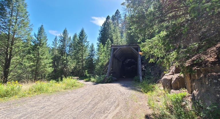
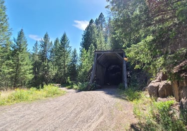
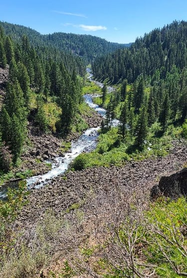
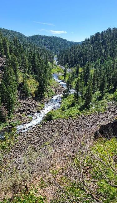
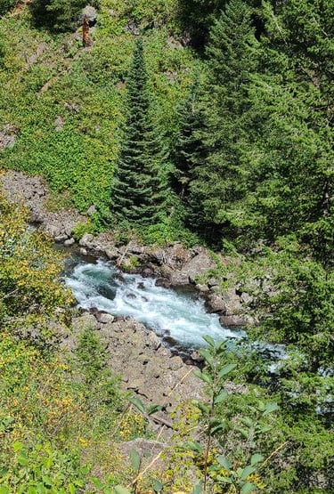
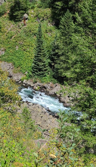
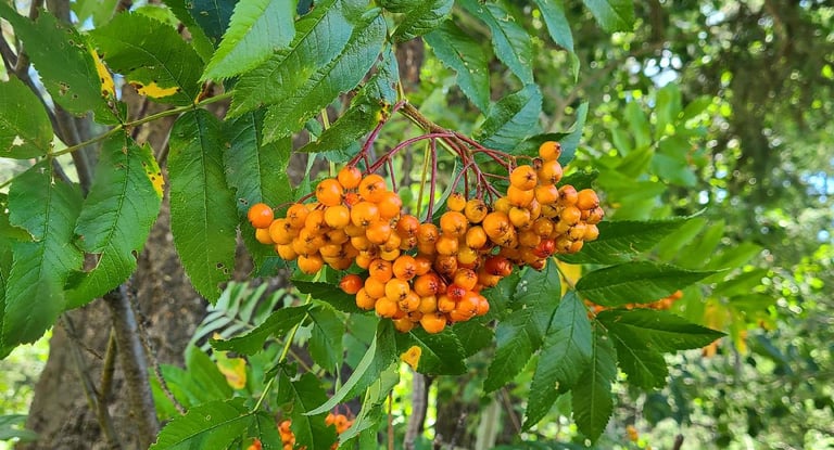
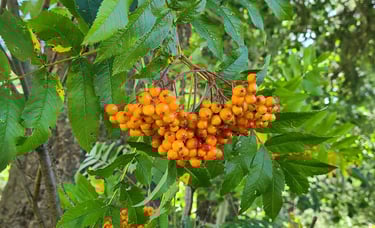
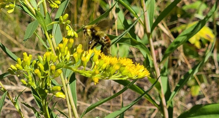
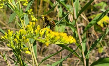
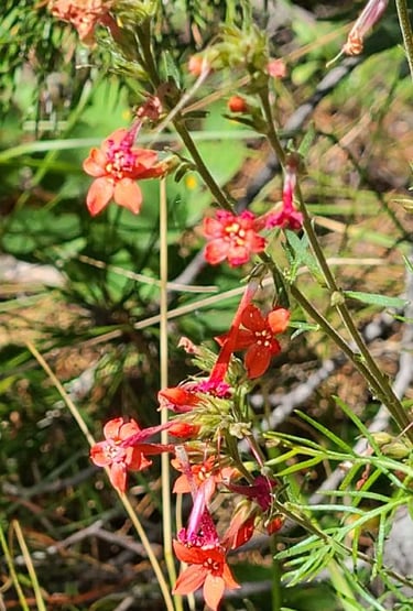
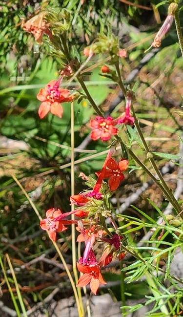
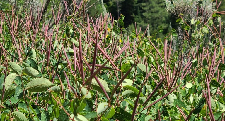
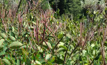
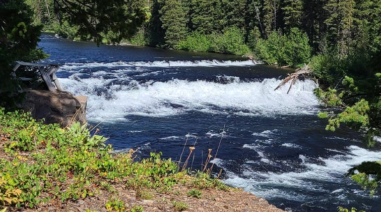
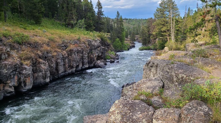
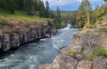
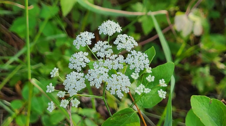
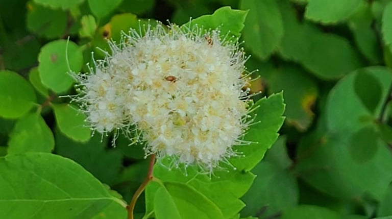
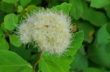
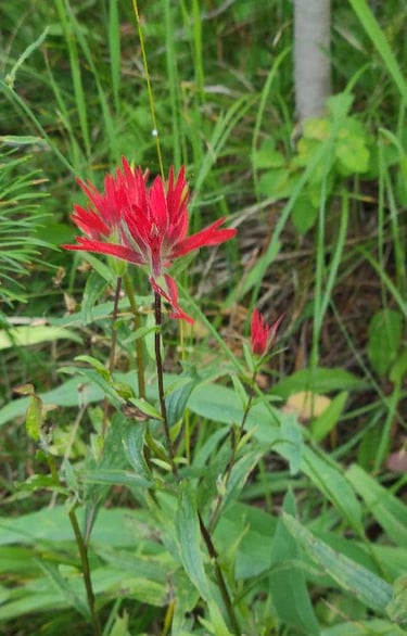
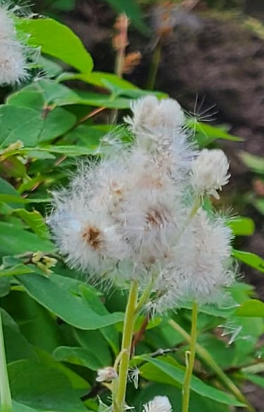
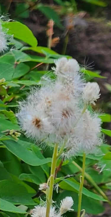
Along the way to the next falls, we had a stop at Bear Gulch Trail. We loaded the girls up again and headed down the trail to find the old railroad tunnel. After not too much distance we did find the tunnel that was part of the rail line that used to take travelers to Yellowstone National Park, but unfortunately time has not been kind to it. The massive timbers supporting the tunnel are impressive, but unfortunately they are collapsing on the near end, and the stone ceiling at the far side has collapsed into a pile of rocks right at the entrance. It is now fenced off and and there are signs posted about not entering the tunnel. It looks like people had disregarded this advice, but we stayed out ourselves. All along the trail the slopes were filled with wildflowers and trees. We saw Mountain Ash berries starting to turn color and flowers like Skyrocket and Fireweed, among others, that the bees and butterflies were working feverishly. Several hundred feet below we were mesmerized by the blue green waters of the Warm River meandering through the canyon floor and the almost perfectly conical spruce trees standing next to it. It was very warm hiking in the afternoon sun, and dodging the four-wheelers, making all of us, girls included happy to be back at the truck when we were done.
We next traveled down a side road to the “back” entrance to Yellowstone NP, where, with a realatively easy hike, we had up close views of Cave Falls. It got it name from an overhang on the west side that looked like a cave, but it appears to have now collapsed as the water continually eats away at the rock. It is not the tallest falls by any means, but at 250 feet wide it is still striking. You can feel the power of the water from the Fall River as you stand at the base of the falls. The water is so white as it crashed over the ledge, but it calms and returns to its deep blue color as it divides and passes by a some tree covered islands that stand firm against the water. This area of Yellowstone is not accessible from the main section of the park.

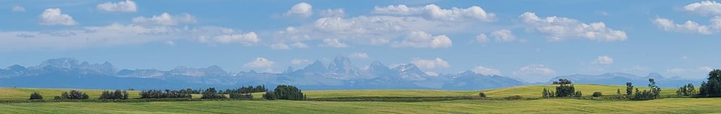
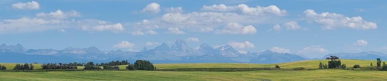
The Teton Mountains made a guest appearance on this trip. As we passed over some hills and around a corner, the west side of the mountains appeared. The peaks are just as impressive from this side, with the fields of wheat in the foreground and puffy white clouds dancing in the sky above. Although the haze of the late day obscured them a little, I still got excited to see them.
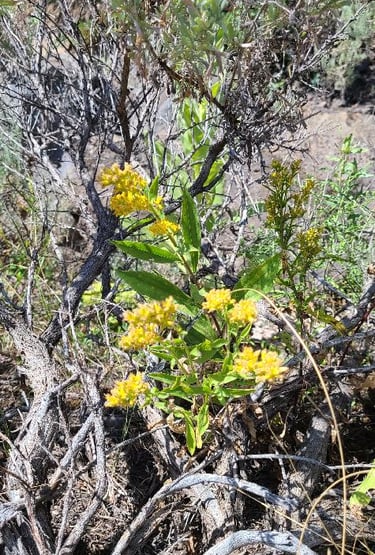
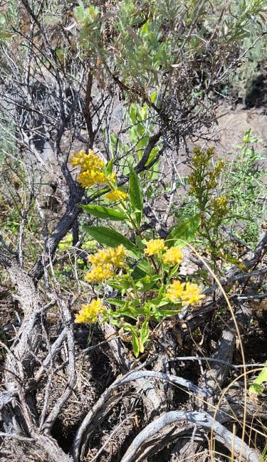
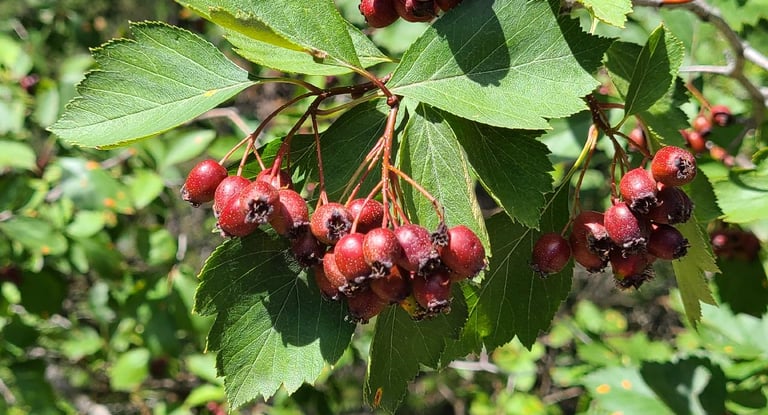
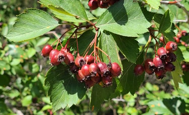
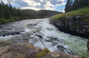
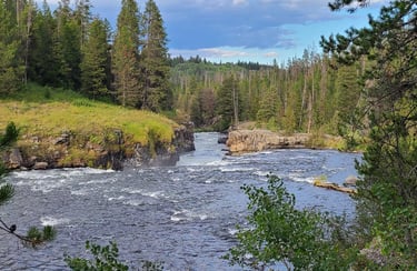
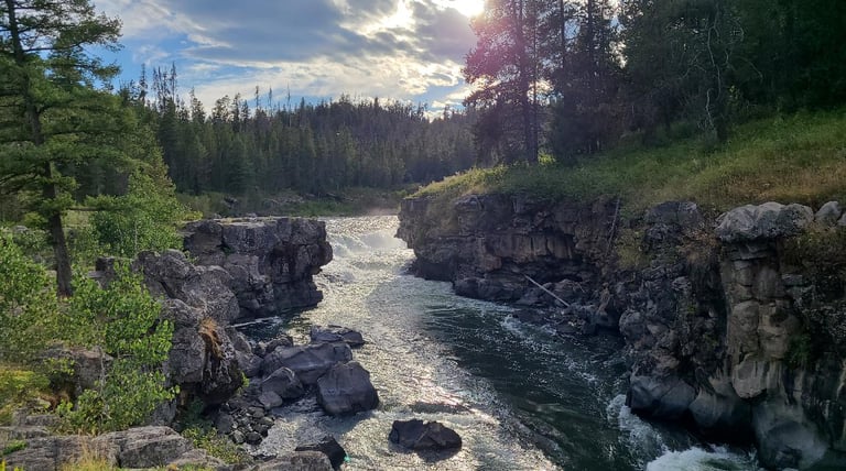
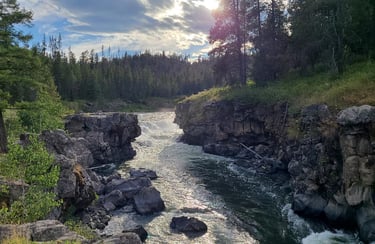
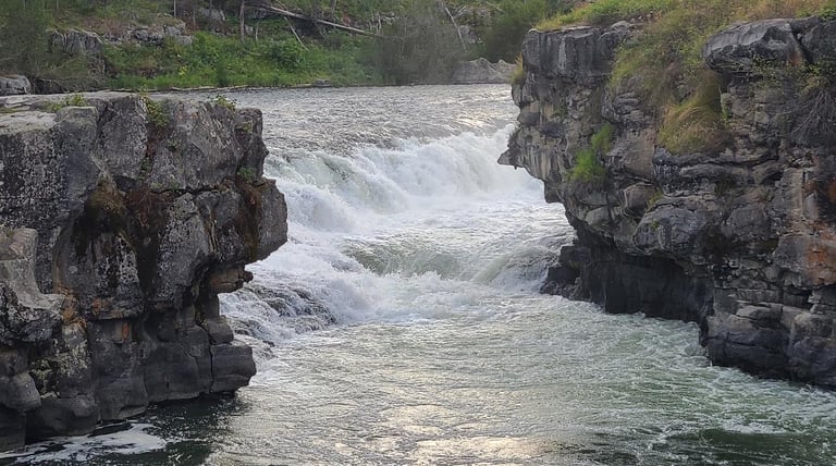
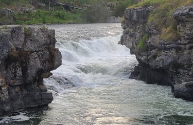
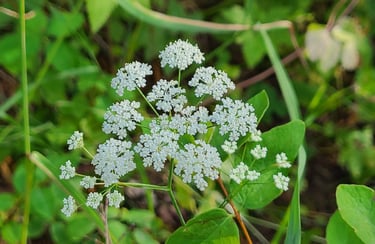
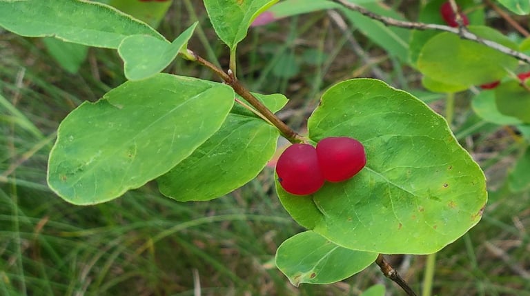
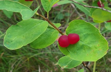
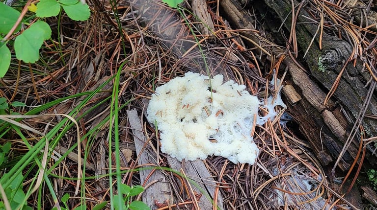
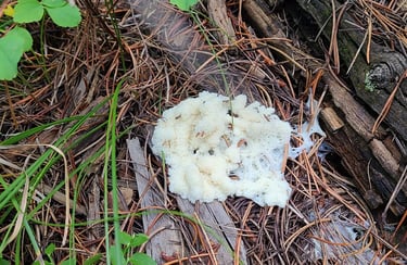
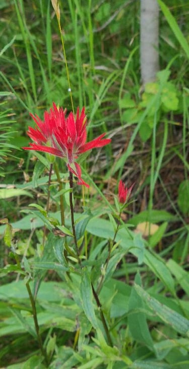
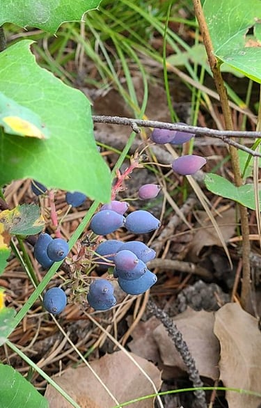
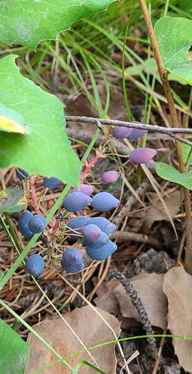
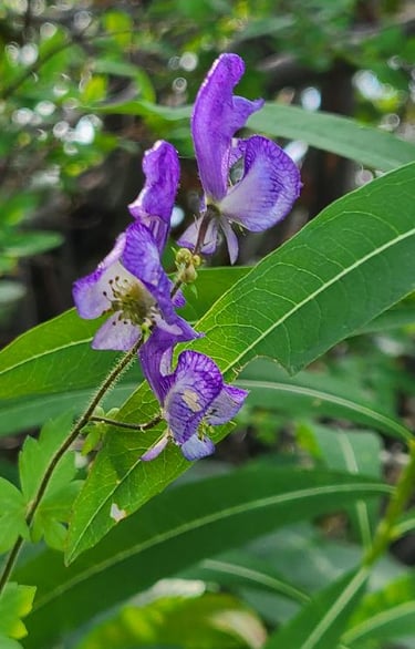
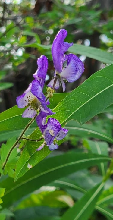
Maybe my favorite falls of the day was the last. After bumping our way down a dirt backroad we made our way to the trailhead for Sheep Falls on Henrys Fork. We were luckily the only ones there too. The mile long trail took us down the hillside to the top of the falls past more wildflowers with colors of purple, white, and yellow. These wildflowers and berries such as Western Monkshood, Utah Honeysuckle Berries and Creeping Oregon Grapes were new to us. We even saw some odd fungus, that was called Dog Vomit Slime Mold when we looked it up. It was fascinating and did really look like dog vomit. These falls were interesting in how the initially wide river above the falls was constricted tightly by the canyon walls below. The falls themselves were on a curve and cascaded around the bend. The sky alternated between sunny and cloudy, producing different effects as we sat there watching the water rush by.
After a full day of hiking and exploring we made it back to the RV to just as the sun was setting and settled into a quiet relaxing night. Suki was really a trooper on the trails today. It was a good day.
Share your comments on Facebook or email us at roadfronts@gmail.com
Subscribe for monthly updates
Current location: