Surviving A Tough Hike, And An Eclipse Too
October 14 - Annular Eclipse - Weavers Cave - Escalante UT - #96 - 2023
FAILS & FIXESNATURE
Tom
10/15/2023
Am I whooped this evening ‘er what? We’ve been camping near Escalante for twelve days, thinking we weren’t going to do anything for the annular eclipse besides hunker down and sit it out. This morning, I had the idea to grab one of our old phones to livestream, and wouldn’t you know, the batteries were both dead. Okay, so grab the polarizing lens from the Sony, tape it onto my Galaxy and see if we destroy it in the process. At least that’s what we’ve been reading will happen if you aim it at the sun, which I did for 2 hours, 20 minutes and 22 seconds. Just a warning, if you watch the video on Facebook, it’s THAT long; go halfway if you want to see the neat part. So far, the phone’s camera seems to have survived unscathed. Also neat, the video time is a palindrome... too bad we didn’t go the extra two minutes!
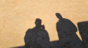
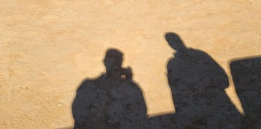
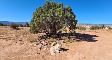
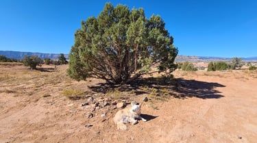
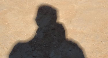
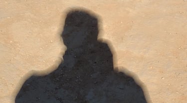
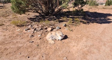
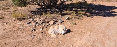
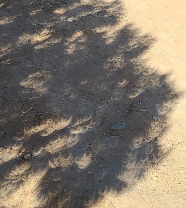
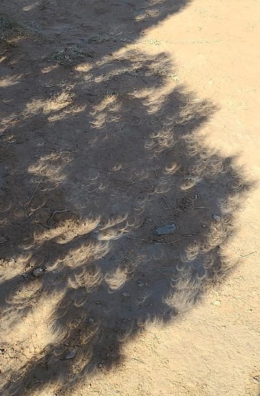
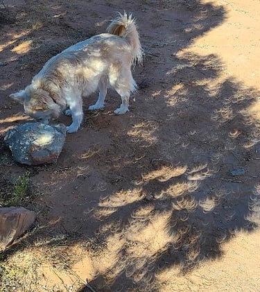
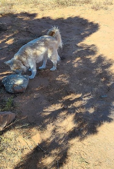
So here we are, never done this before, and we are livestreaming, making it up as we go along. At first, I was frustrated with the blue dot, likely a speck of dust on one of the lenses, but then the blue dot started to turn into a crescent, which meant it was representing the sun being blocked by the moon. It turned out rather neat, totally by accident. I had Al snap pics of the circular shadows cast by the leaves from a nearby tree, while our shadows were showing up doubled and blurry. Suki took a little nap during the dimness, and wasn’t all that impressed when she woke up. Betty was annoyed that she wasn’t getting her usual heat while perched on the passenger seat. As for the livestream, we were surprised to see new people watching from places we have no connections. I would say it was a success. Thank you Terry, Sandra, Shari and Joan for talking with us on the phone while we streamed!
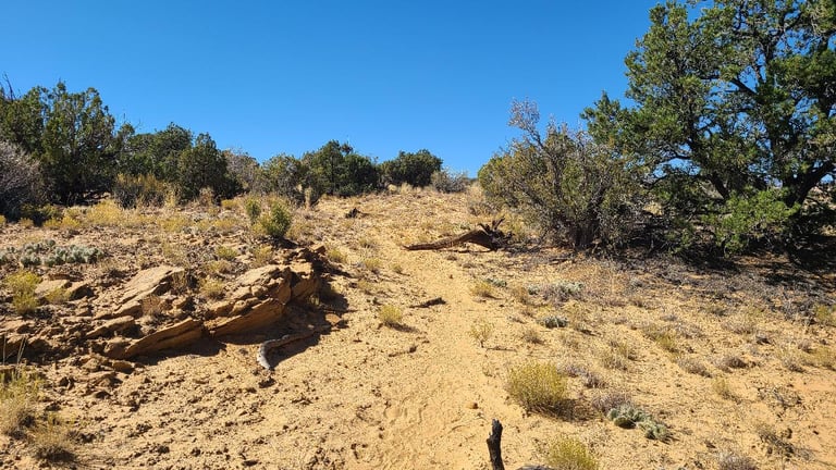
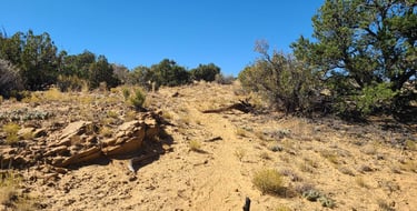
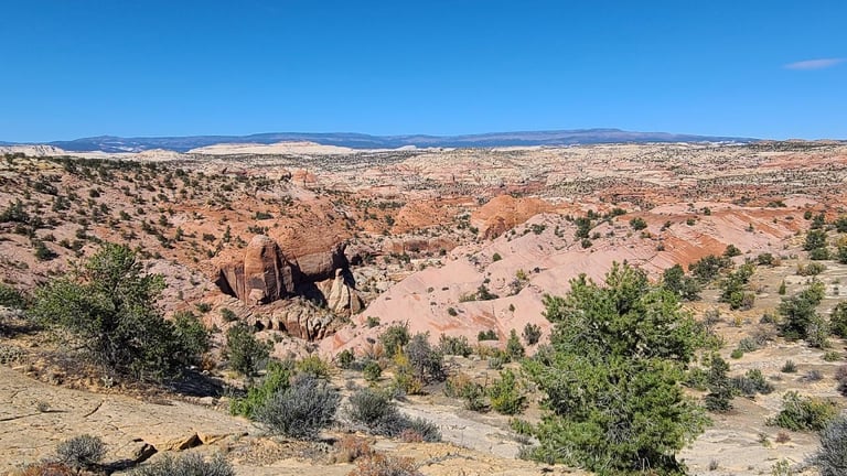
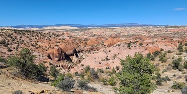
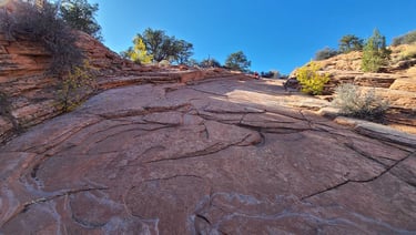
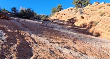
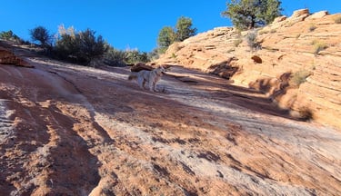
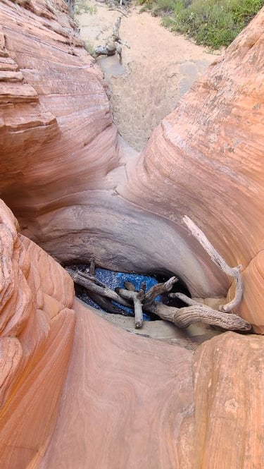
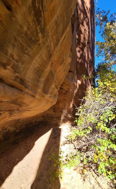
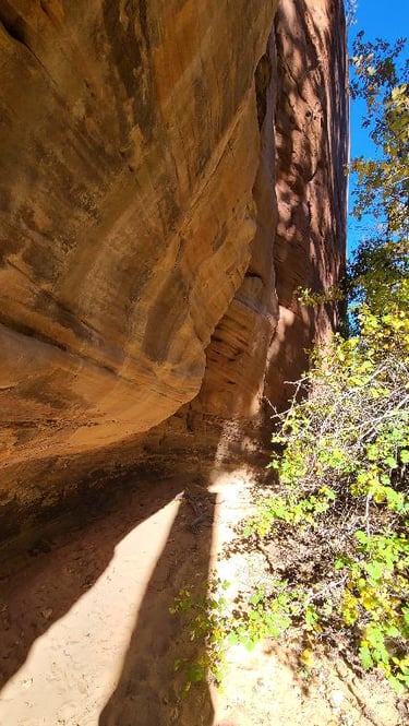
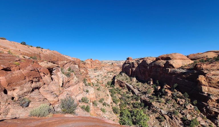
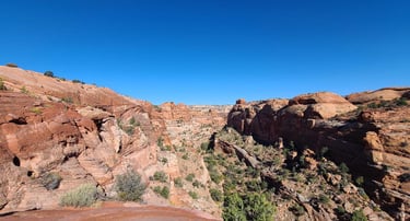
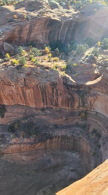
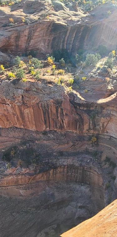
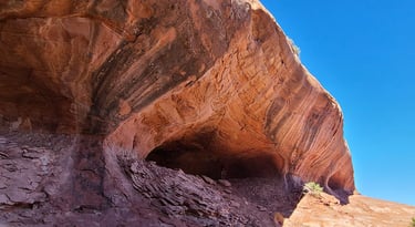
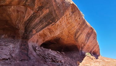
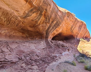
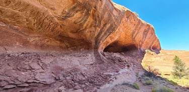
After the video, we finally had some cereal before getting out for some exploring. As it was not a labeled trail, we were not certain about much besides vague directions from a dated website. The start of the trail was sandy and level, but all of a sudden, we were on slickrock and had no more sand or footprints to follow. I had Al download the area Google map to at least give us a location to strive for, but the cliffs made it much more difficult for navigating. We took several wrong turns, having to backtrack up and down some of the steepest terrain I’ve trodded, but the canyon floor was a couple HUNDRED feet down the edge, and I knew we weren’t at the right altitude. We may have been thirty or so feet directly above it at one point. I nagged at Al a bit as he wasn’t keeping us updated with navigating or directions. Eventually, we made it to the wash we were looking for, and Holy Crap, did it turn steep! Suki was very unsure as we scaled down the slickrock, but then we came to a bigger obstacle: a deep pool whose crossing log has fallen in. We locked wrists as Al lowered down inside and through, dropping off Cassie in her pack, coming back for Suki, then again to help me cross. The second pool was shallow and dry, much easier to pass.
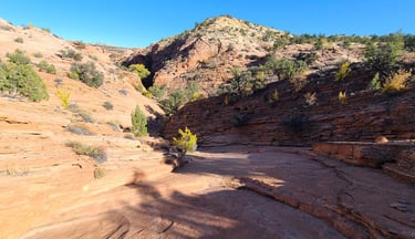
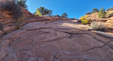
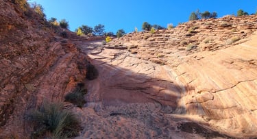
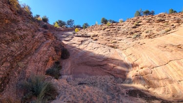
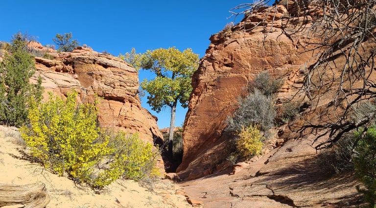
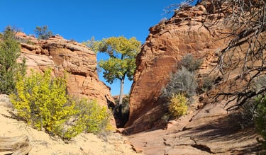
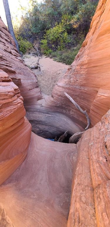
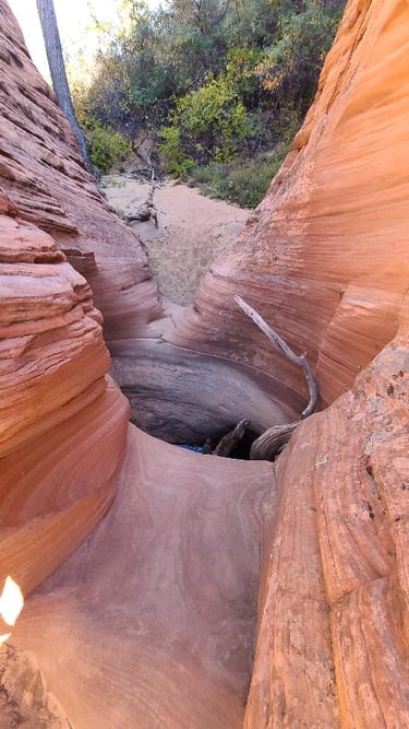

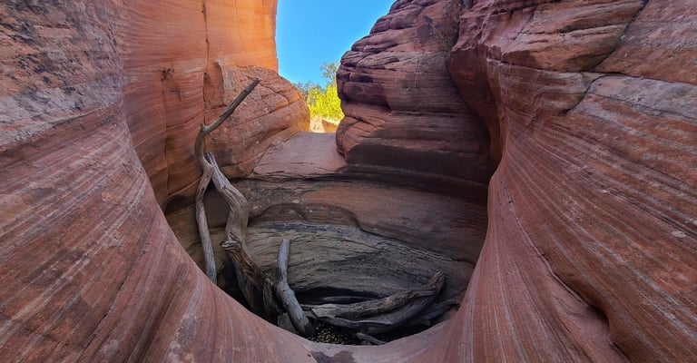
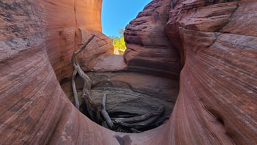
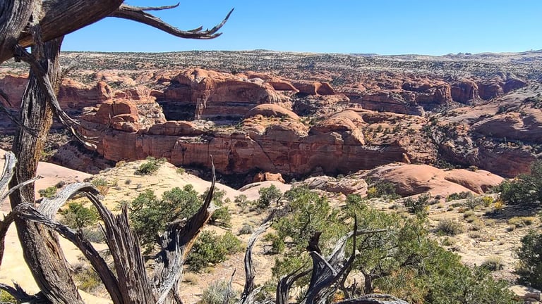
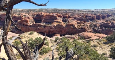
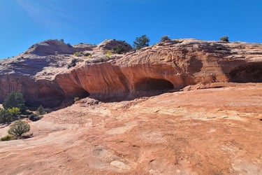
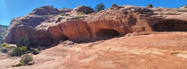
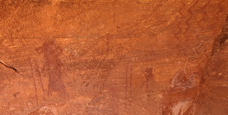
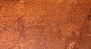
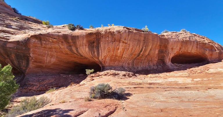
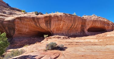
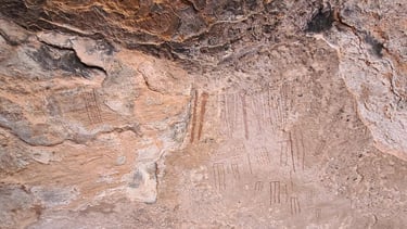
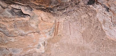
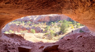
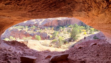
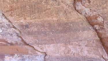
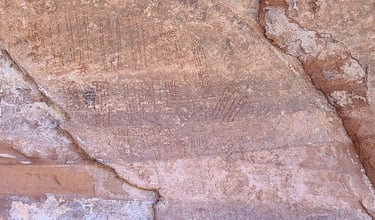
From here, the trail was very sandy again, meandering through a couple alcoves. Coming out of those, the dry wash, when wet, spills over an incredibly deep drop, levels off, then drops again a time or twelve to the canyon floor. Luckily, the caves were just in front of us, so we didn’t have any lower to go. There is an ammo can with a visitor logbook and laminated sheet saying general archaeological etiquette. What was unique here was that most of the rock art is very linear, like hash tags or denoting a fortress, or maybe it’s a tally of how many lizards chasers have jumped over the edge.
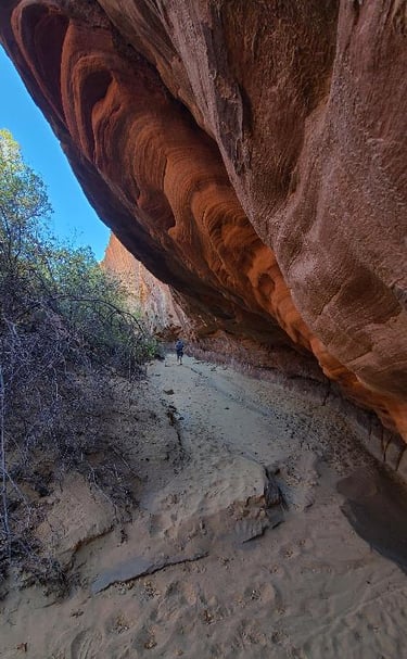
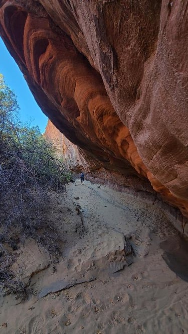
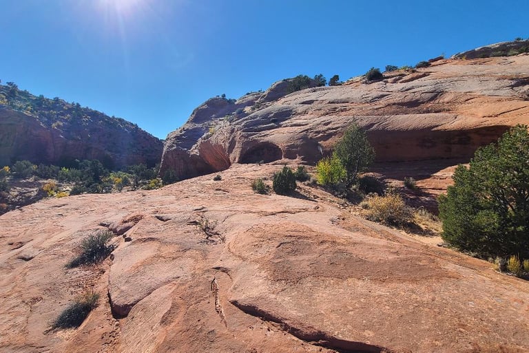
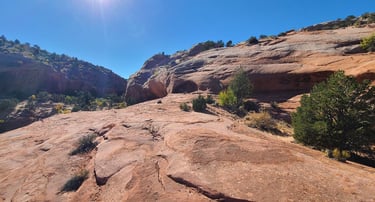

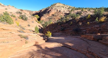
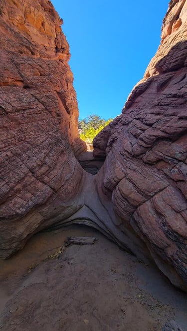
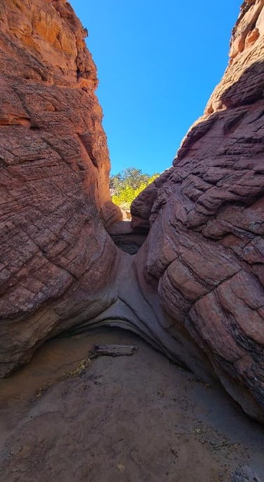
Heading back, the trail directions say there is an easier pass to the left going up, but we didn’t see anything but sheer rock faces. Crossing the pit was much easier uphill, or at least less intimidating. Climbing that steep slickrock has done a number on my entire foot and ankle, and I am REALLY painfully paying for it tonight. I negotiated with Suki that if she could make it up, I could make it up, and if I could make it up, she definitely should be able to. The coaxing paid off as we made it to the top, actually following other footsteps the entire way. Al’s phone shut off due to a dead battery, so we had no more map to guide us, and mine was hanging in the low teen percentages, so we were all glad to see the truck appear in our sights.
On the way home, we were both thinking that burgers sounded good. While I’ve been working on photos and writing this, Al made us some grub with my guidance. I had him sauté some onions, pineapple and bacon with some brown sugar and a little ketchup. He topped the burgers with that combo and lightly squashed some pre-baked potatoes in butter, topping them with sour cream and crumbled bacon. Everything was scrumptious and we will definitely make that again.
Takings from the day... Sometimes when things aren’t going well, they actually go better than intended, as was the case with the earlier dead phone batteries, and the blue spot on the screen. I was surprised my phone battery lasted through the livestreaming and taking pictures on the hike. It’s been a very good day, if I’m able to walk tomorrow, we may attempt another hike. I’m not betting on the odds of it working out, but we will see.