
Copper is Queen
November 29 - Bisbee and Naco, AZ, #127-2023
SNAPSHOTS
AL
12/3/2023
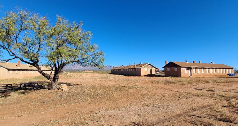
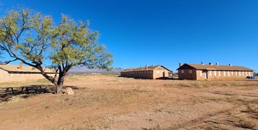
Within sight of the border in the small town of Naco, Arizona, is Camp Naco. Built as a show of force during the Mexican Revolution, its main purpose was to prevent the turmoil from crossing the border. It is the only military post built of adobe construction and one of few that remain. Several buildings are still standing, most tattered and some without roofs, visibly abandoned and neglected for decades. A sign talks about preserving it for future visitors to admire, but it does not look like anything is being done. I wonder if the government could be approached to sell it to someone or a group that could restore it and/or live there?
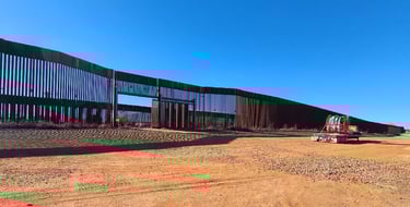
The US-Mexico border has a massive, double wall of vertical metal slats. The Mexican city of Naco is on the opposite side, making the wall have a very divided feeling, like the town was split in two. At this point in our history, we should be able to co-exist without something so intimidating. The wall is stark and forboding with its rusty metal construction dominating the landscape. I can’t imagine how the people living there must feel, having to see it constantly. It would be wonderful if the section through town could be painted, or if artists were allowed to paint murals on it, so that it would feel less like a prison.
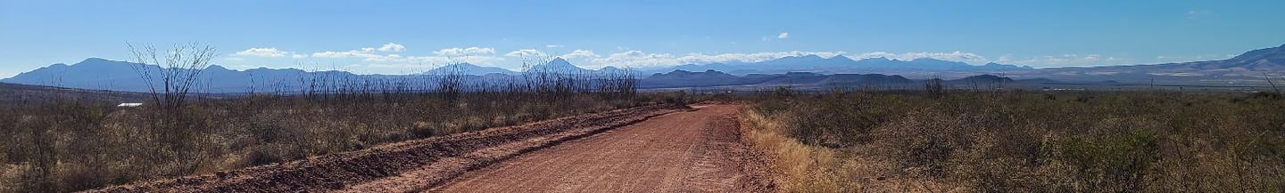
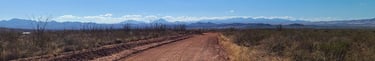
Making our way to Bisbee on the backroads, we encountered several Border Patrol conveyances; trucks, ATVs, even a mounted horse. They seemed disinterested in our passing through, while their attention was focused on scouring the desert landscape. Looking behind, it was a little weird knowing the mountains we saw were in another country, unavailable for our exploration.

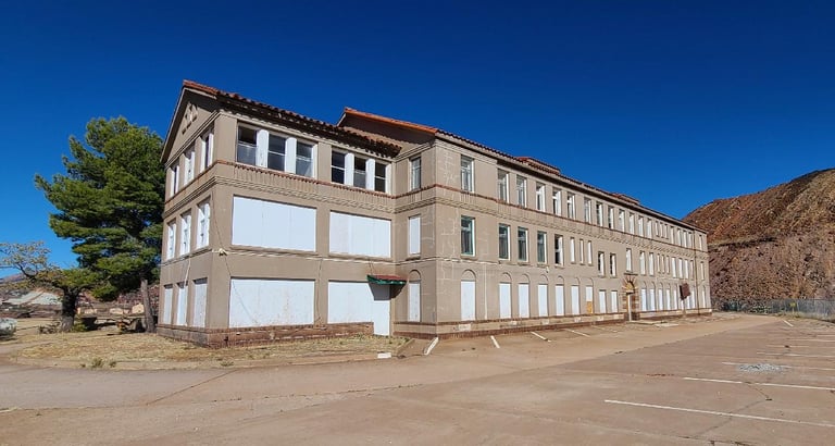
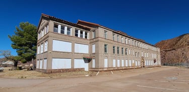
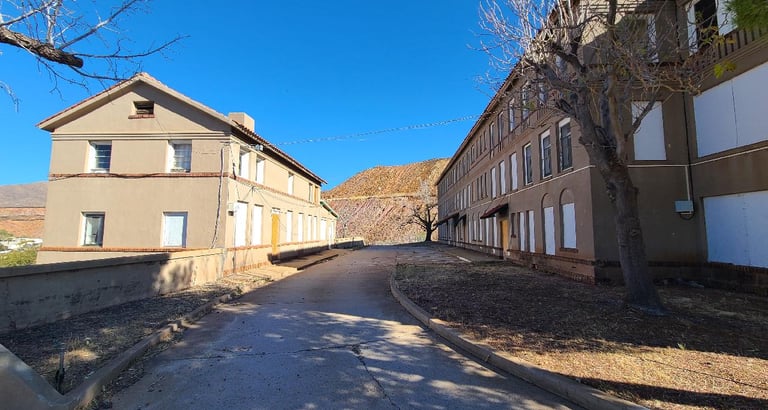
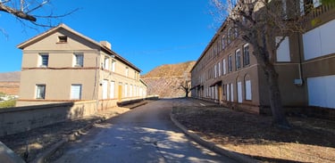
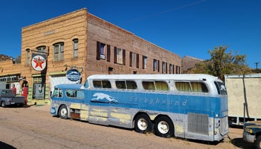
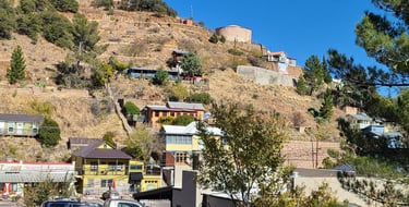
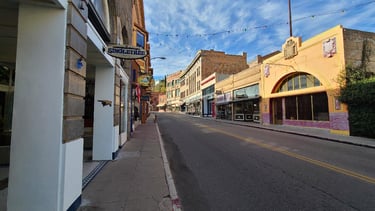
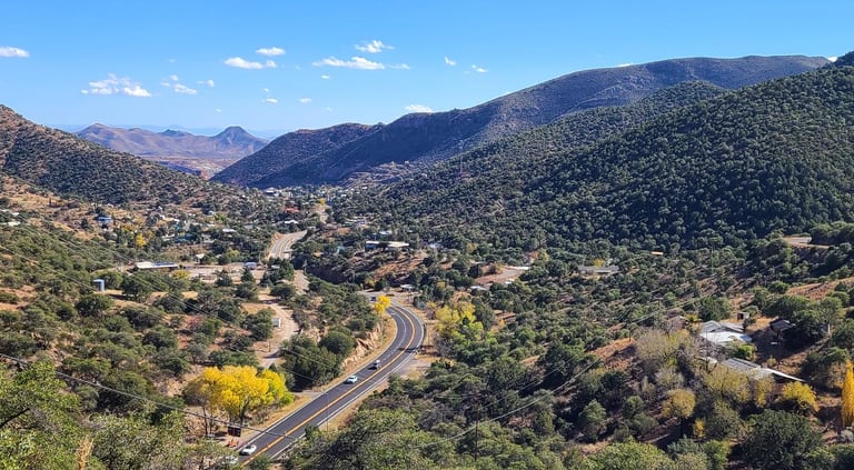
Bisbee is a town steeped in mining history. Copper, gold and silver were mined here. The evidence can be seen all over town. The first indication was a substantial building at the top of the hill in Warren. It sits right at the edge of the spoil piles from the mining operations. We later found that it is the Old Mining Hospital and now owned by the City fof Bisbee. It turns out they are planning to turn it into affordable housing.
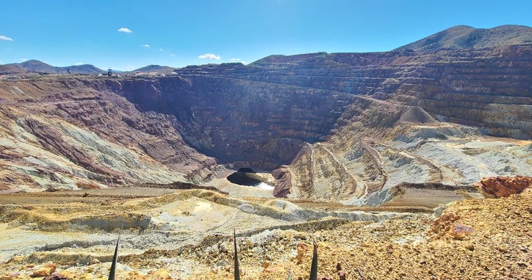
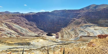
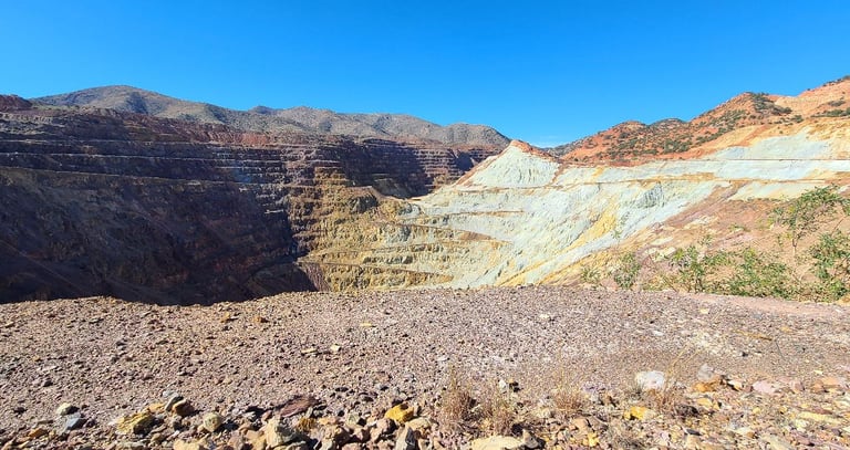
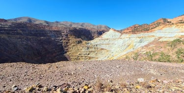
The Lavender Mine is an open pit in the middle of town. Although mining stopped in 1974, it is an enormous hole that remains to this day; enormous as in 4,000 feet wide, 5,000 feet long, and 850 feet deep! I was fascinated by all of the switchbacks and terraces leading to the bottom, but I think it would be better to reclaim and restore the area to a natural state. There are enormous piles of rock left from the mining process that could help fill it in.
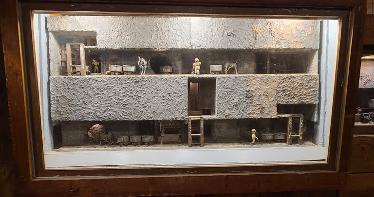
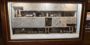
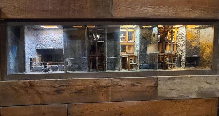
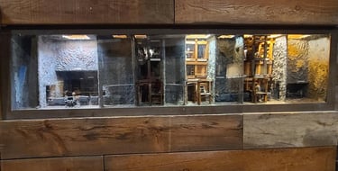
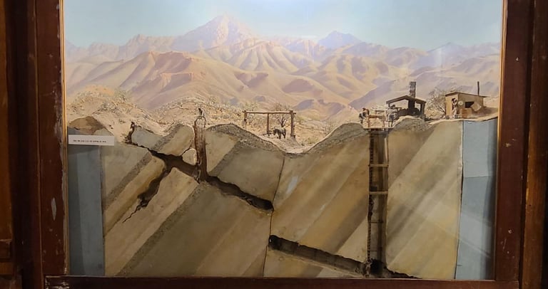
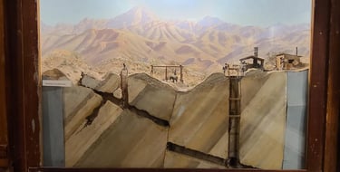
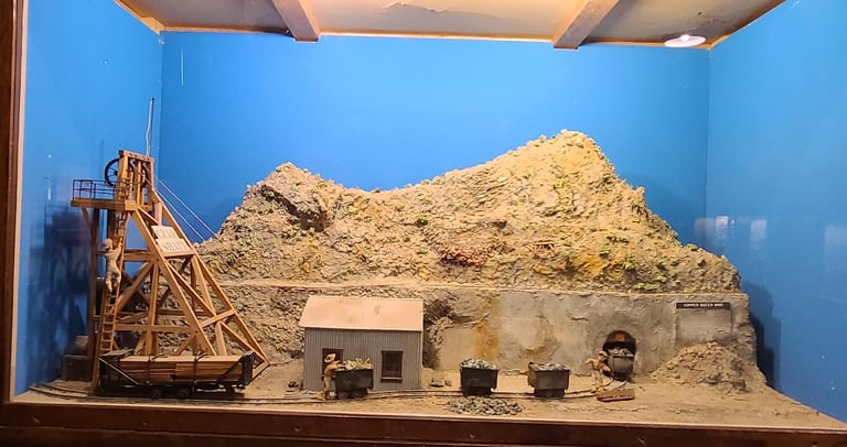
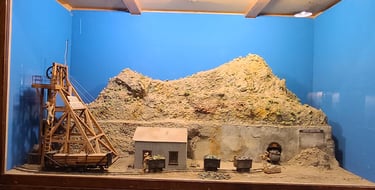
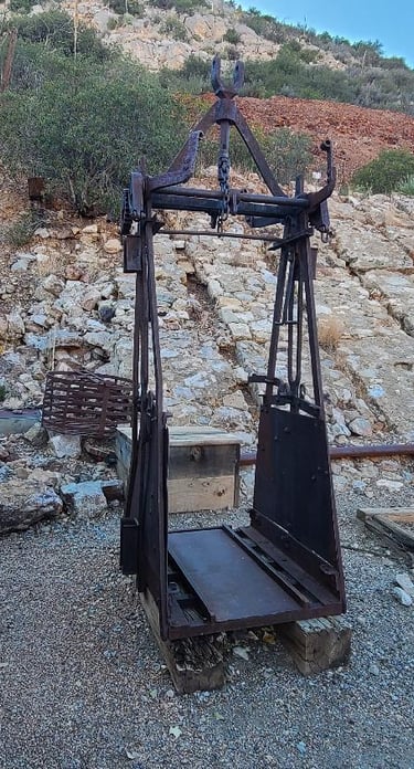
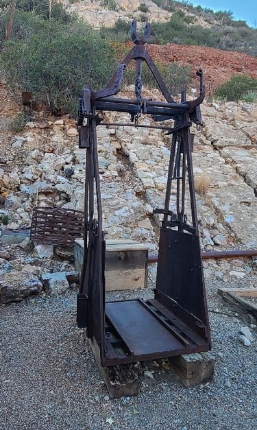
Nearby, the Copper Queen Mine offers tours and is much less visible as it’s composed of underground tunnels. Dioramas inside the visitor center show how the tunnel mines looked and how the equipment was used.
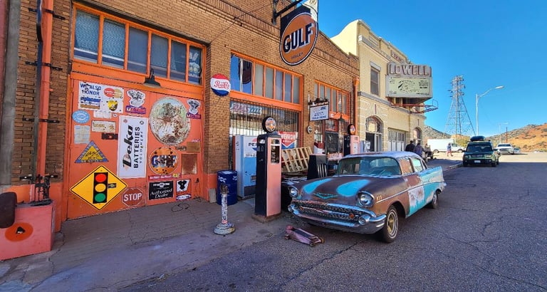
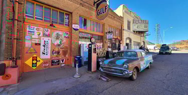
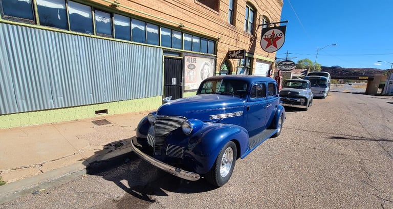
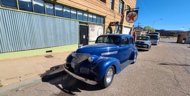
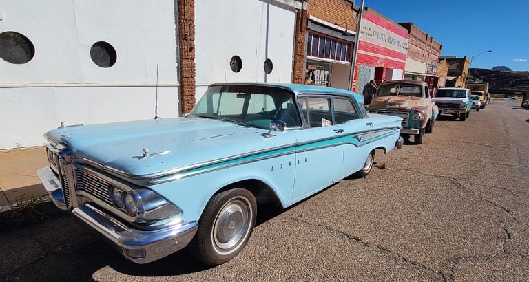
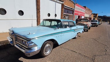
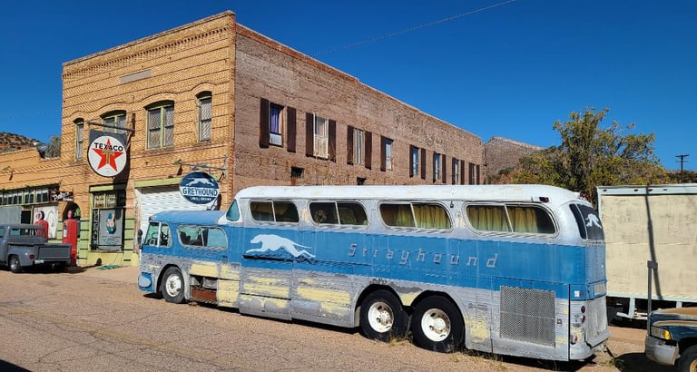
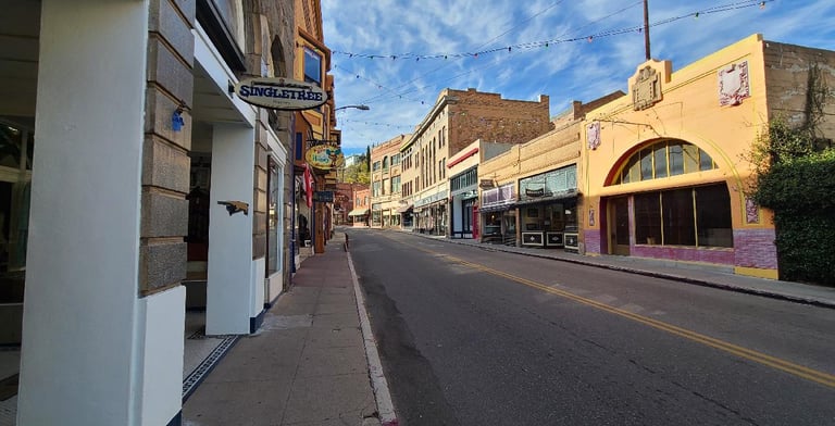
The open pit mines consumed much of the small town of Lowell, but the buildings along Erie Street, next to the mine, remains locked in time. They remain like they were back before 1950. Old vehicles line the street like they would have when this was a bustling mining town. We were a little disappointed that much of it, including the cars, are not better maintained as it could be a fantastic throw-back.
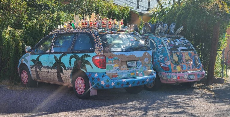
Up by the courthouse, rather than turn downhill to exit, Tom drove forward to point out a couple stange art-cars that caught his eye. A Caravan had Santa and angel figures glued to its roof, while the PT Cruiser had owls and owl skeletons. This is a town of art and eclecticness. Across the highway we saw several homes on the hillside whose only access is from a long set of stairs. There are no roads going to these homes. That would be some workout getting to and from work each day! I wondered how they got materials up there to build them.


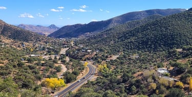
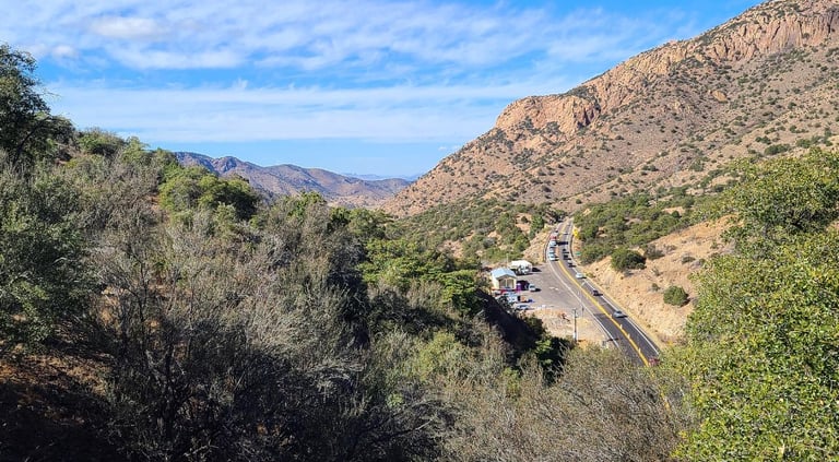
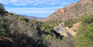
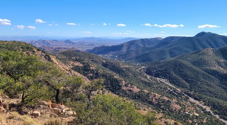
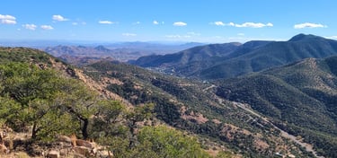
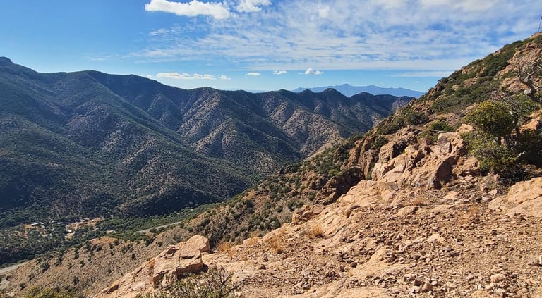
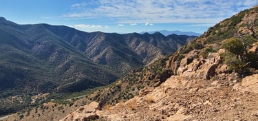
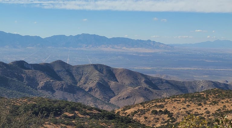
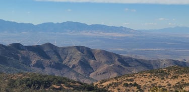
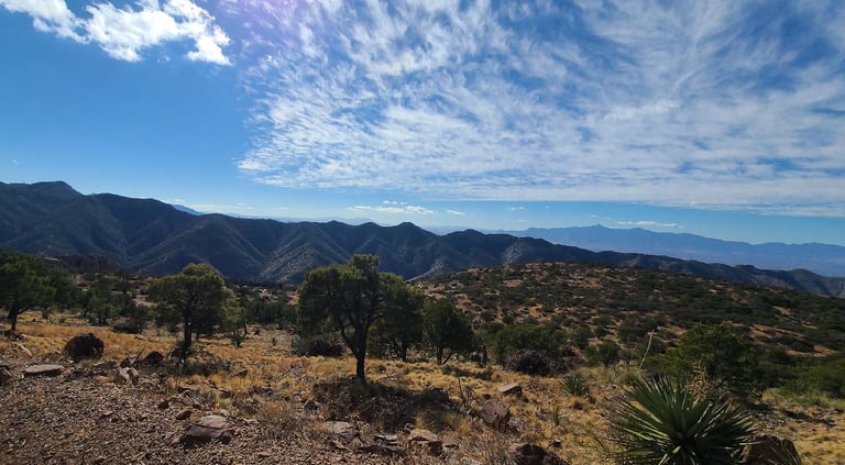
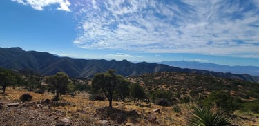
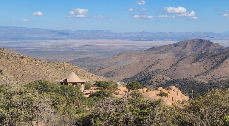
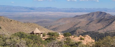
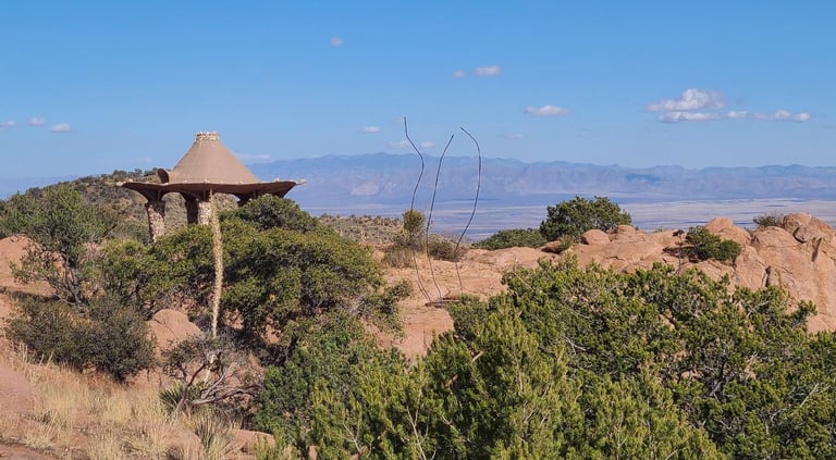
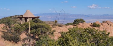
Meandering up the mountain, we found several pull-offs that overlook the valley into town. Fall is hanging on, evident by the yellow cottonwood trees below. We stopped at the Mule Mountain Tunnel overlook before heading up on Juniper Flats Road, where expansive views show the high desert plains and the mountains that eagerly rise from them. It was surprising how the small trees seemed to prosper on the slopes alongside the yuccas and cacti. We noticed the drastic difference between the slopes with south facing ones being very rocky, rugged, and less vegetated, while the north facing slopes were almost completely green with trees and other foliage. From our high vantage point, we could see straight grid lines laid out in the plain below, maybe they were streets laid out but never built. The roads gradually became narrower, more rocky, and washed out the further we climbed, but the views grew more spectacular, showing the town, the plains, and curving roads below. Views reached into Mexico. We passed a couple homes whose roofs had unusual shapes, designed to collect the rain that falls on them. One of them looked like a sombrero. We also saw several dispersed camping sites up there as it was BLM land, but it was very windy, and at this time of year with an elevation of 6800 feet, it would be quite chilly. They are isolated and quiet, but I am not sure we would want to take the motorhome up here.
Today we went into a car show in Sierra Vista. We walked around admiring the wide ranging collection of cars and trucks gathered there. My favorites were probably the Olds Cutlass and the AMC AMX. Tom chatted a while with a retired army sergeant about his rare 1988 Porsche 944 Turbo S, both appreciating the knowledge each shared. His cars are my petroglyphs.
Share your comments on Facebook or email us at roadfronts@gmail.com
Subscribe for monthly updates
Current location: