Beauty of the Beast
October 12 - Hells Backbone and Posey Lake, Escalante, Utah #105-2023
BYWAYSNATURE
AL
10/26/2023
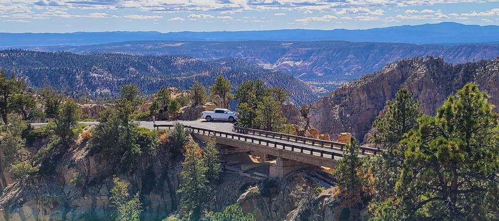
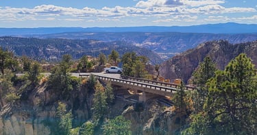
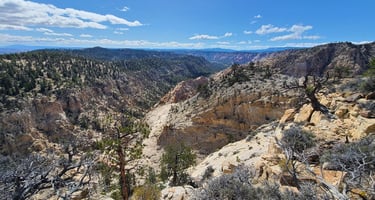
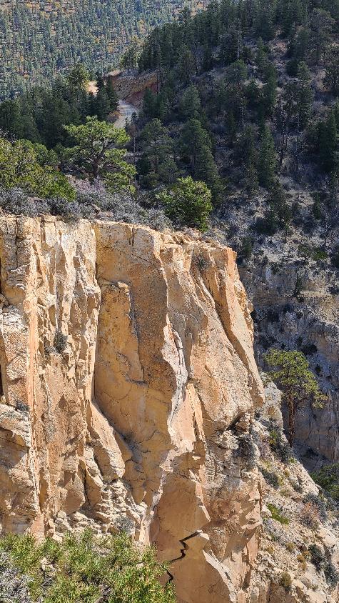
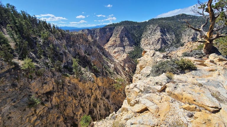
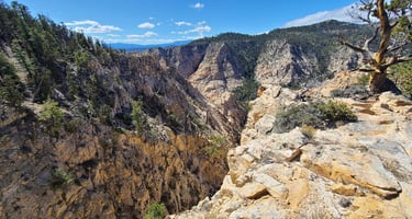
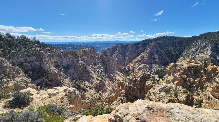
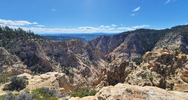
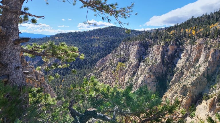
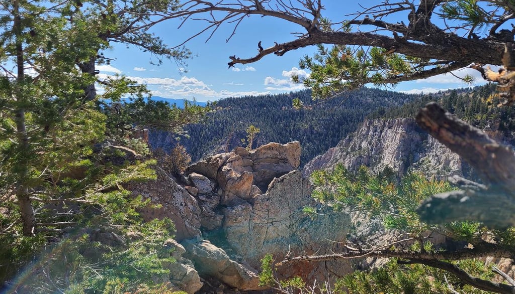
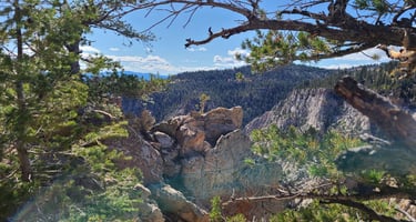
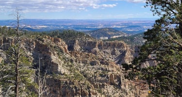
Hells Backbone Scenic Drive was the original automobile route connecting the isolated towns of Escalante and Boulder, Utah, and scenic is an understatement. It is named after a very narrow ridge, this hogback separating Death Hollow and Sand Creek Canyons. The narrowest section of the backbone was only wide enough for a walking trail, with near vertical drop offs of 1,500 feet on both sides. In 1933-1934, the CCC took on the perilous task of constructing a wooden bridge at this location, which I would say is quite the engineering feat, considering the terrain. We learned an antedote from the construction of the bridge involving a man named Sixty McInelly. The crew had just laid and fastened two long pine logs across the chasm. When the dozer and air compressor were needed on the other side, Sixty agreed to drive them across the pine logs. He inched his way onto them and slowly made his way across, while the onlookers held their breath and prayed. Having walked across the bridge, I know I wouldn’t have been able to do it. Thankfully he did, and the road and bridge are here for us to drive through this spectacular terrain. The original bridge has since been replaced twice, with the current bridge just being wide enough for one lane of traffic. The CCC also built the road connecting the bridge to the towns. It is a wonderful, slow-paced gravel road, twisting and winding through canyons and ridges as it climbs higher onto Boulder Mountain.
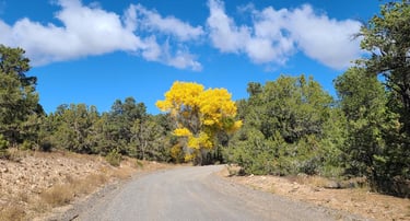
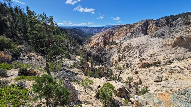
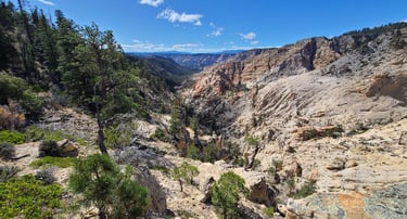
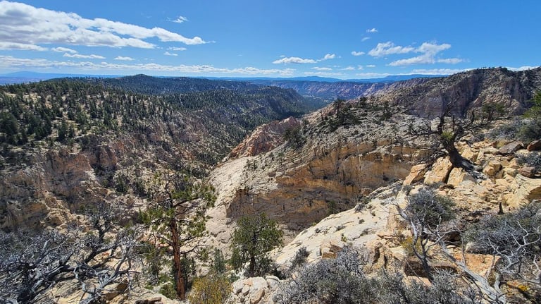
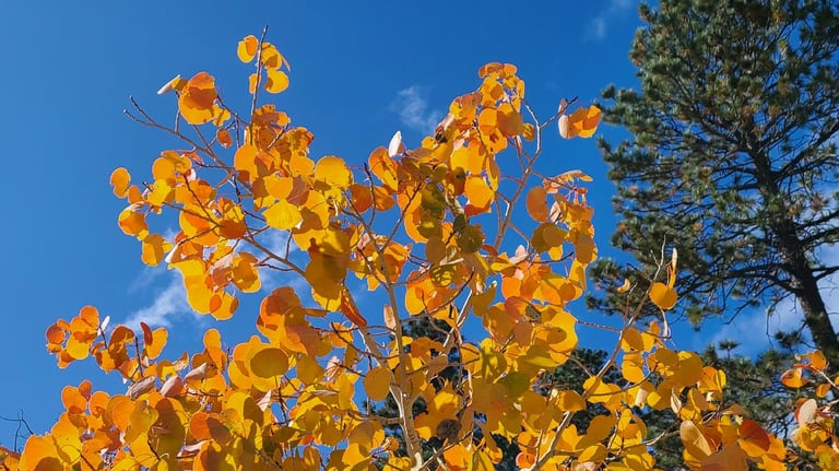
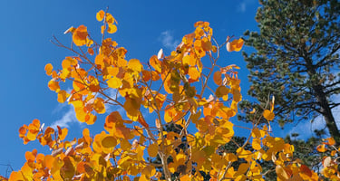
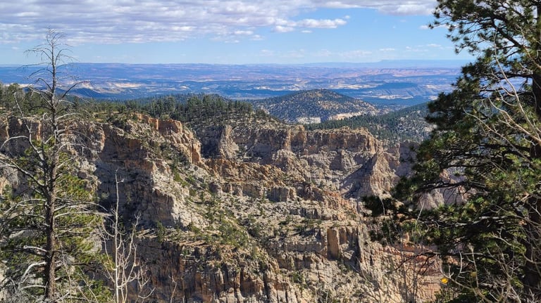
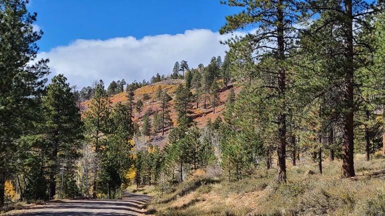
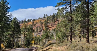
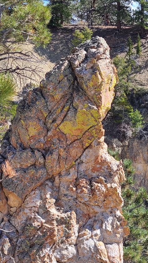
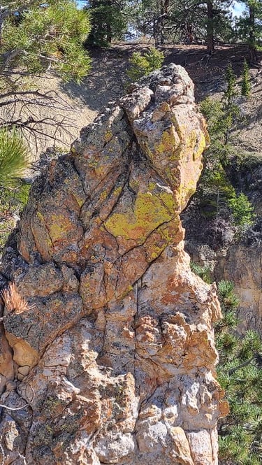
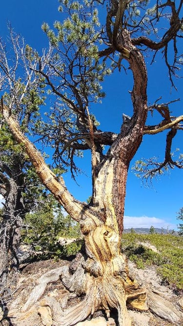
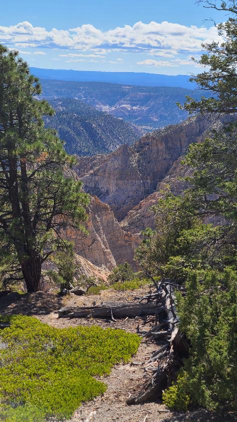
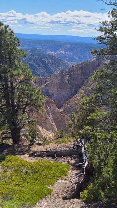
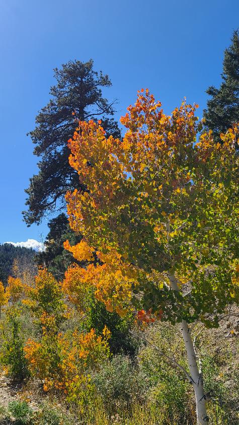
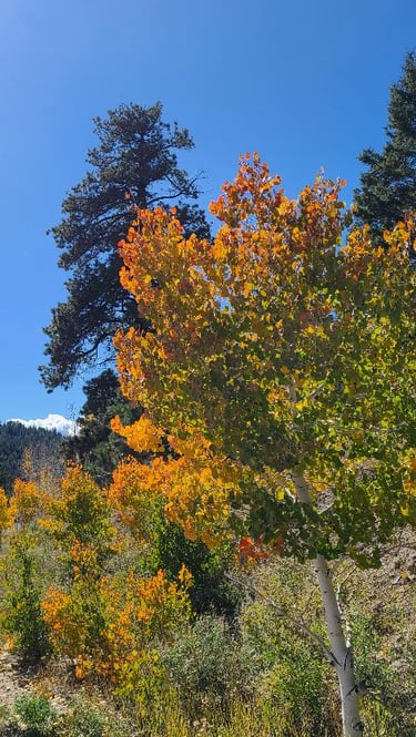
Our drive started near Boulder, winding through juniper and sagebrush desert into the evergreen and aspen groves of the Dixie National Forest. The fall colors burst atop the green canvas of pines and spruces. Like a snake, we serpentined up the curvy road to the bridge. As we neared the backbone, our surroundings started to drop away, and I was awestruck seeing the rugged beauty of the canyons take over. Layers of rock and deep canyons sprawled out for miles before us. I didn’t know where to look first, and photos never really capture the true essence of the view. We were daring and walked close to the edges, peering down at the sheer walls below us. The twisted and gnarled old trees held firm in the rocky terrain, giving us something to grasp for support.
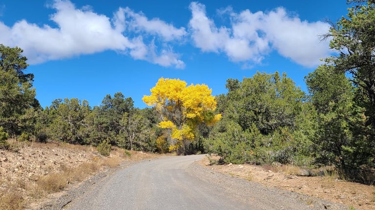

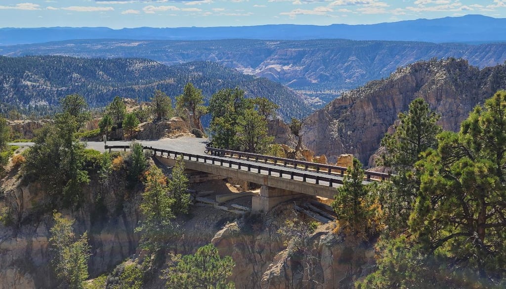
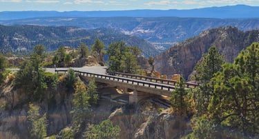
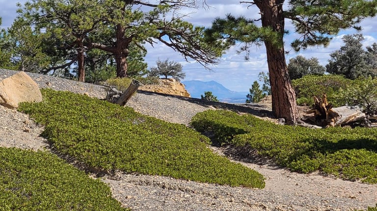
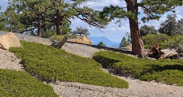


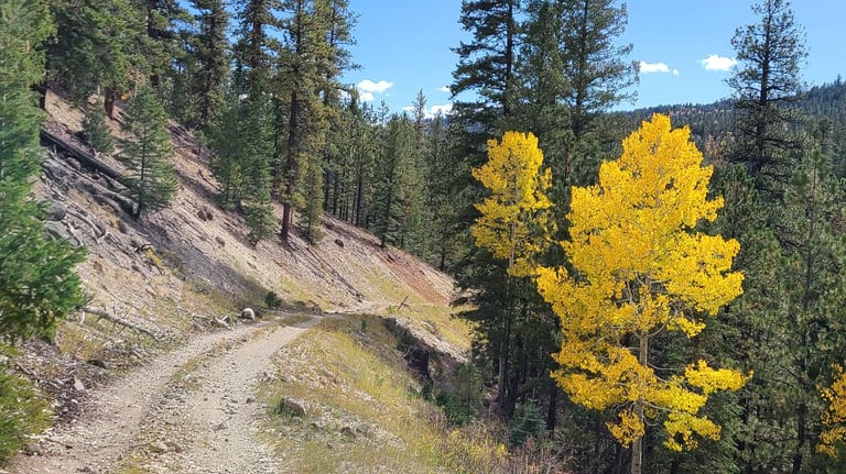
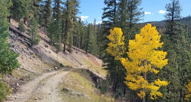
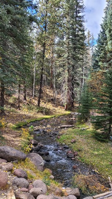
Ascending above the Devils Backbone Bridge, we detoured through a few of the side roads. Some took us to dispersed campsites, most of which were too rough for our motorhome. Others led through forest and cattle grazing meadows. We stopped for a moment to appreciate a mountain stream that passed under the road. Since spending the last several weeks in desert environments, it was a welcome sight to see a clear, cold creek among lush pines such as this. Then we passed over another three or four streams! Where did they all come from?
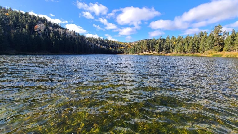
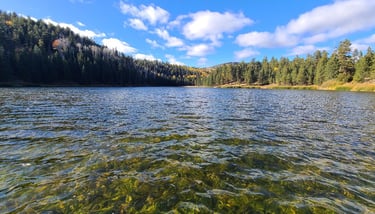
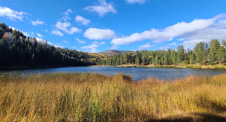
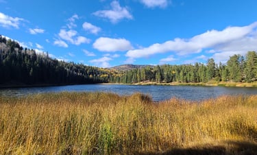
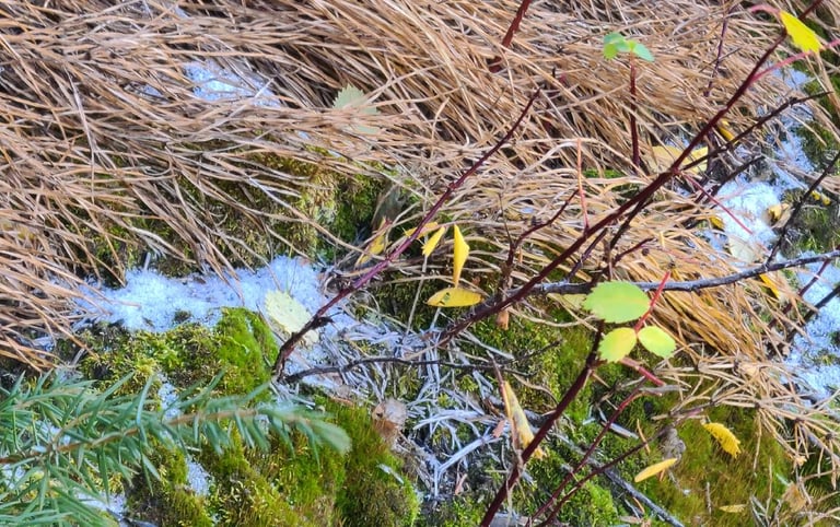
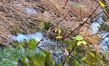
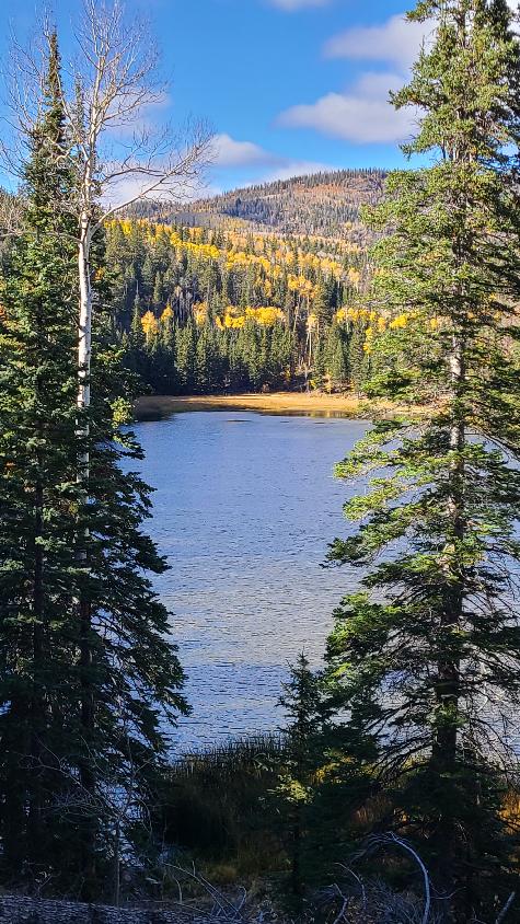
A sign for Posey Lake lured us to be sidetracked again. It is a tranquil alpine lake filled with clear blue water. There was just enough breeze to put ripples on the surface, but it felt cold there, as evidenced by the smallest little patch of snow. Camping season was over at this elevation, but the campground here seemed very pleasant.


At one place we passed, a large tract of the National Forest was being clear cut. We questioned whether this was right or not, as our thoughts were that a national forest was designated to help preserve it in a natural state. I think that the wildlife in this area would be put in turmoil, and soil erosion would increase, but I could be wrong. On the plus side, it opened up the view to the valley, which you would not have with the trees still there. Other than this it was a stunning day, full of sights and landscapes galore. I would recommend the drive to anyone passing through this area.
Today, we negotiated on a vehicle, but could not come to satisfactory agreement with them. We will keep the truck a little longer and see if a better deal developes. Pizza hit the spot for dinner tonight. As for the rest of the evening, time will be spent plotting where we will be moving to next, possibly even tomorrow. If we travel tomorrow, it might be a few days for the next post.
Share your comments on Facebook or email us at roadfronts@gmail.com
Subscribe for monthly updates
Current location: