Backroad Exploring
September 20 - Gooseberry Road & Pando - #74-2023
BYWAYSNATURE
AL
9/21/2023
We had planned on taking a drive to see Pando today. Pando is a clonal colony of Aspen trees that shares an entire root system. According to mass, it is the largest living organism on Earth, occupying 108 acres of land and weighing an estimated 6000 tons. It resides in the Fishlake National Forest in Utah. We’ve intended on seeing “The Trembling Giant” a few times, even getting within an hour of it, but for one reason or another, we hadn’t. It’s been a priority to get there this year around the time the leaves change color but have not yet fallen. Today, our determination got us there.
Before we left, I made sure to clean the truck’s windshield so we’d have better views and less glare. While we didn’t leave as early as we’d like, we still had ample time for what the day had in store. The truck’s navigation suggested a longer route on main highways, but Tom decided to follow the backroads for half the mileage, then taking some of the side roads that branched out from it. Many of the side roads were rough and bumpy, but with new tires on the truck, we made it through with no problems. I’m grateful that he ventured off course, as we saw many things we would have missed, such as reservoirs, free campsites, overlooks, mountain passes and more.
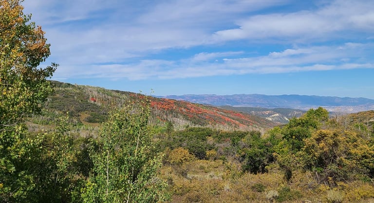
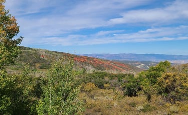
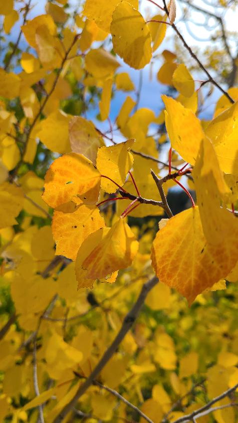
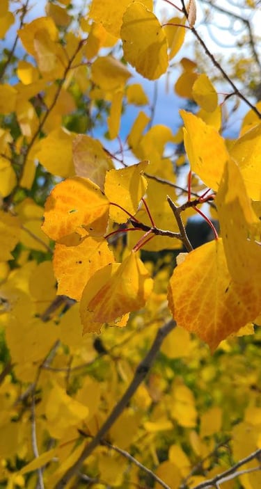
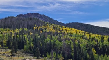
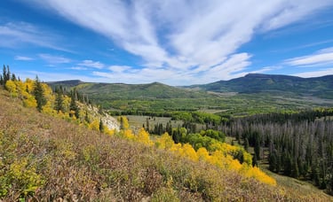
I love seeing that the fall colors are starting to pop around here. The maples are putting on their best show of reds and the aspens are starting to display their yellows. The aspens even have a little red/orange to their leaves, which is something I did not know. I thought they were only yellow. The reds and yellows are a pleasing contrast to the greens of the tall and skinny pines and spruces. Many leaves are just starting to change. We may have to come back in another week or two in hopes they’ll be at peak.
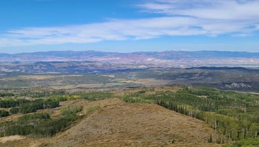
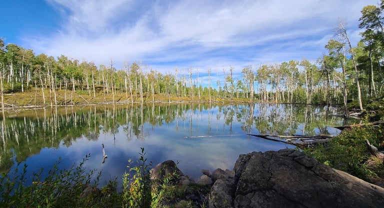
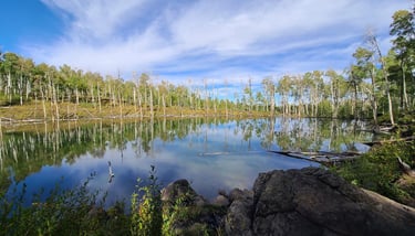
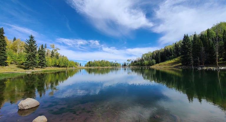
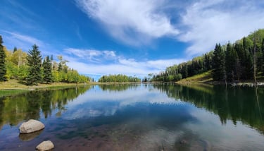
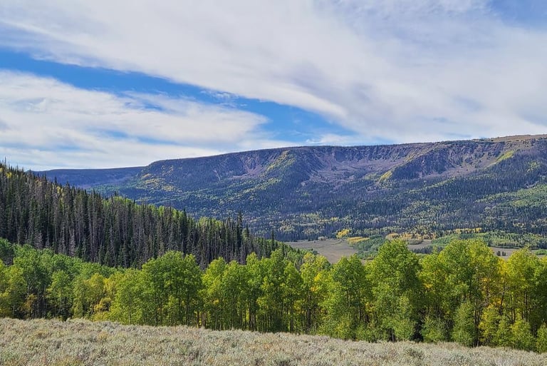
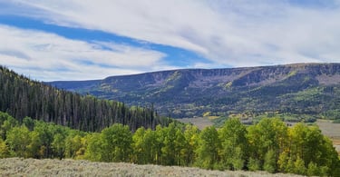
All along Gooseberry Road we saw several free campgrounds within the Fishlake National Forest, and many opportunities for dispersed camping outside of the campgrounds as well. I could see us spending the entire 16 day allowable stay when we come back possibly next year. At the far end of one of these camping areas was a small pond called Cold Spring. Except for the cattle hanging out, it was so calm and quiet that the surrounding landscape reflected in the water’s surface. This area has an extensive ATV trail system, and many of the sites were occupied by enthusiasts. We encountered a large group of ATV’s on one of the side roads. Tom was pleased that the first one stopped to say there are sixteen ATV’s all in a row behind him, asking if we could wait for them to pass, and we obliged. Another spur led to an overlook area, where we hiked to the top of the hill, watching the whole valley opening up on the other side. We paused for a moment to admire it before continuing to Gates Lake at the end of the road. It too had a mirror-like finish, with very clear water. Tom noted that it looked like an infinity pool as the land seemed to disappear at the far end. On our way out, we saw some deer dart into the woods, but they were too quick for us to get a picture. Too bad for you... at least we got to see them! I remember someone telling me, seeing wildlife shouldn’t be planned... they should be happened upon.
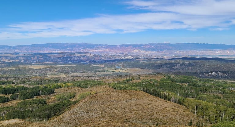
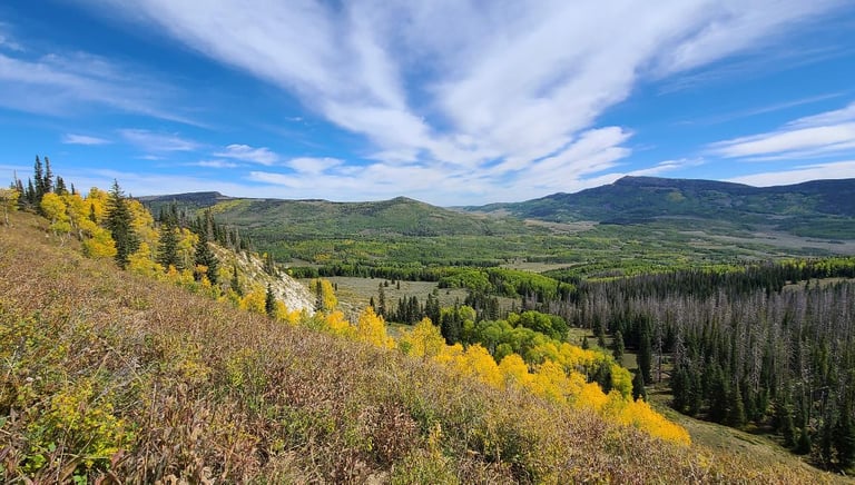
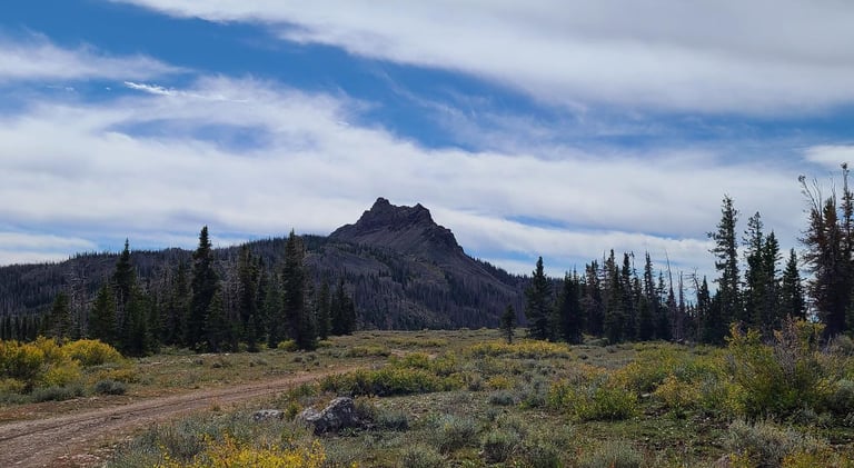
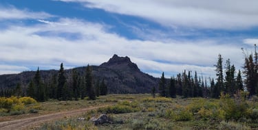
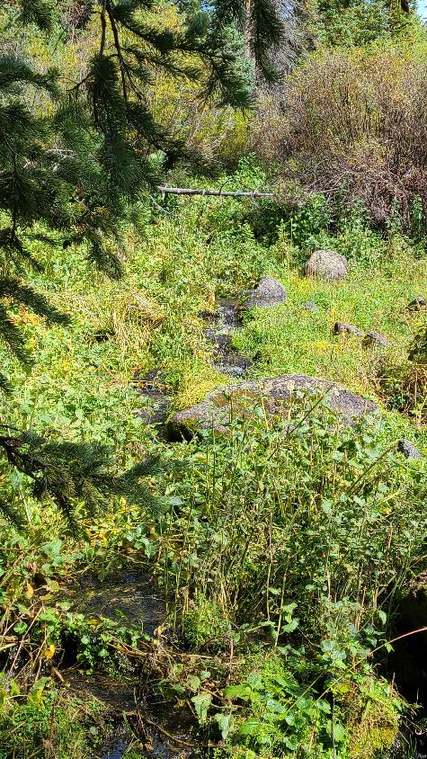
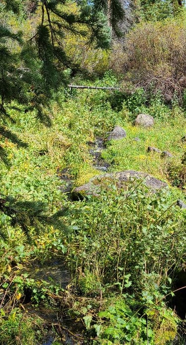
Back out to the main road, Tom stopped the truck suddenly, then made a u-turn. Apparently he only saw the word “PASS” on a sign and wanted to see more of it. It said “Sawmill Creek 1” and “UM PASS 2”, so up to UM Pass he went, thinking that there could be a good view from the top of the pass. Arriving at Sawmill Creek, Tom pulled over, sending me & Suki to check it out. She & I went off into the woods, following the sound of the water. It was amazing to see the creek coming out of the ground in many places like a spring. It was spreading and branching out in different paths before collecting itself further downstream. It was cold enough to spring water, so maybe we did find the source point, but the brush in the area prevented further exploration. Suki thought it tasted pretty good. At the top of UM Pass Road, the truck’s navigation wanted us to continue onto the ATV trail to Pando, but the truck is more than the 50” width restriction. We stopped at the turn around and continued by foot a short way down the ATV trail . We were treated to some great views of the mountains and valleys on the other side, with a splashes of yellows from the aspen trees overhead. At an elevation of 11,624 feet, Mount Marvine rises as a sentinel above UM Pass. I had to look it up, but the pass was named after United Maroni Order, a group of Mormon stockmen who worked in the area during the Pioneer days, and is one of the highest mountain roads in the state.
As we neared our intended destination, we made our way around the Johnson Valley Reservoir and Fish Lake. This is one of the earliest inhabited places in Utah. They have found spear points here from over 9,000 years ago, stating this is one of the earliest examples of summer homes. Maybe another time I could hike these trails, but the clouds were getting fuller, and so we trucked the last few miles to our goal.
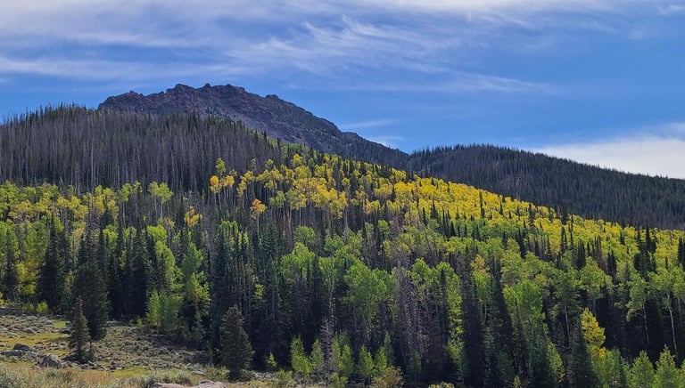
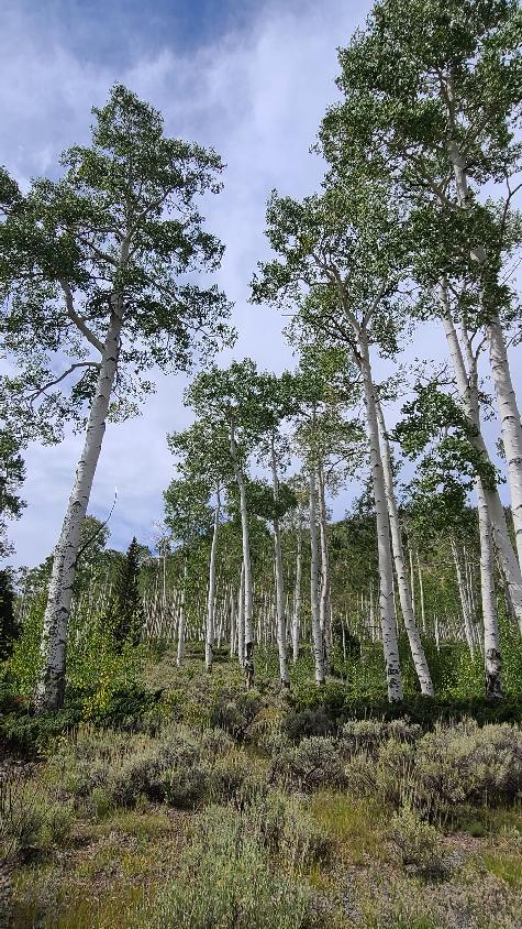
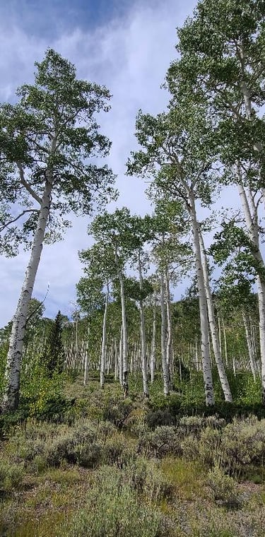
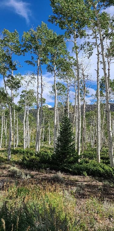
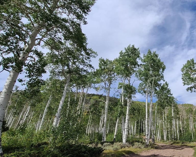
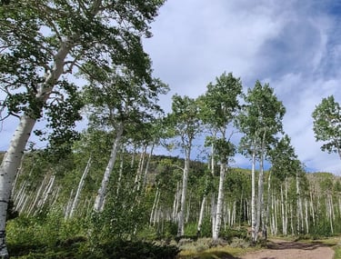
We were hoping to see Pando in full fall color, but we were a little too soon. The golden hues are starting to appear far behind high along the hillside, but most of the trees are still displaying their green color. I still found it to be both powerful and peaceful standing among these trees with their brilliant white bark and impressive height. I think I could listen to the leaves rustling in the wind for hours.
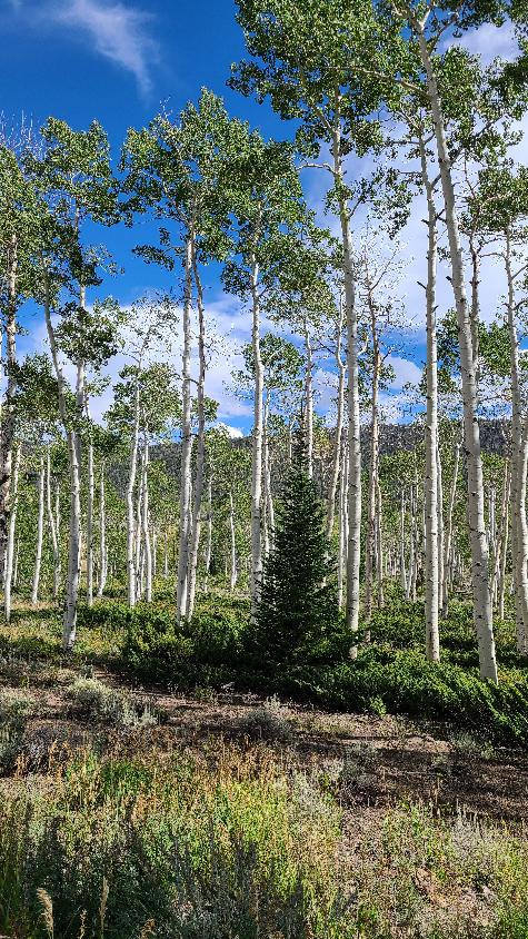
Tom was really hoping for the experience to get deep in the middle of the colony, but traversing the large rocks along the roadside would be too challenging. He asked that I trek deeper in to get some video, then he proceeded to pick up trash alongside the road, overfilling an entire garbage bag. I misunderstood and only got footage from the road, unusable as each one had the overwhelming roars of vehicles driving by, missing out on capturing the sounds of the wind and rustling leaves. I feel bad that I did not get the video as I could have helped him experience it virtually.
We took another route back home to the RV and had some excellent views of the valley as we came down from the heights of the mountains. The various rock formations kept changing in shape and color. I think we saw gray, white, yellow, red, maroon, and green in various combinations. We also passed a rest area with a dumpster, for a proper place to deposit the trash bag of bottles, cans, cardboard, plastic, and styrofoam, where it belongs.
Back at the motorhome, we had work to get done. We got through some of our photos, wrote this post, and now we have to decide if we want to travel tomorrow, and make supper. The high point today was standing among the trees in Pando. Another thing I could have done better would have been to help navigate, since we had the map books with, and suggest roads to take, instead of just relying on him. I am thankful for all we seen today, and to be able to share it with Tom. I know it’s not always enough, but I will keep on trying.
Share your comments on Facebook or email us at roadfronts@gmail.com
Subscribe for monthly updates
Current location: